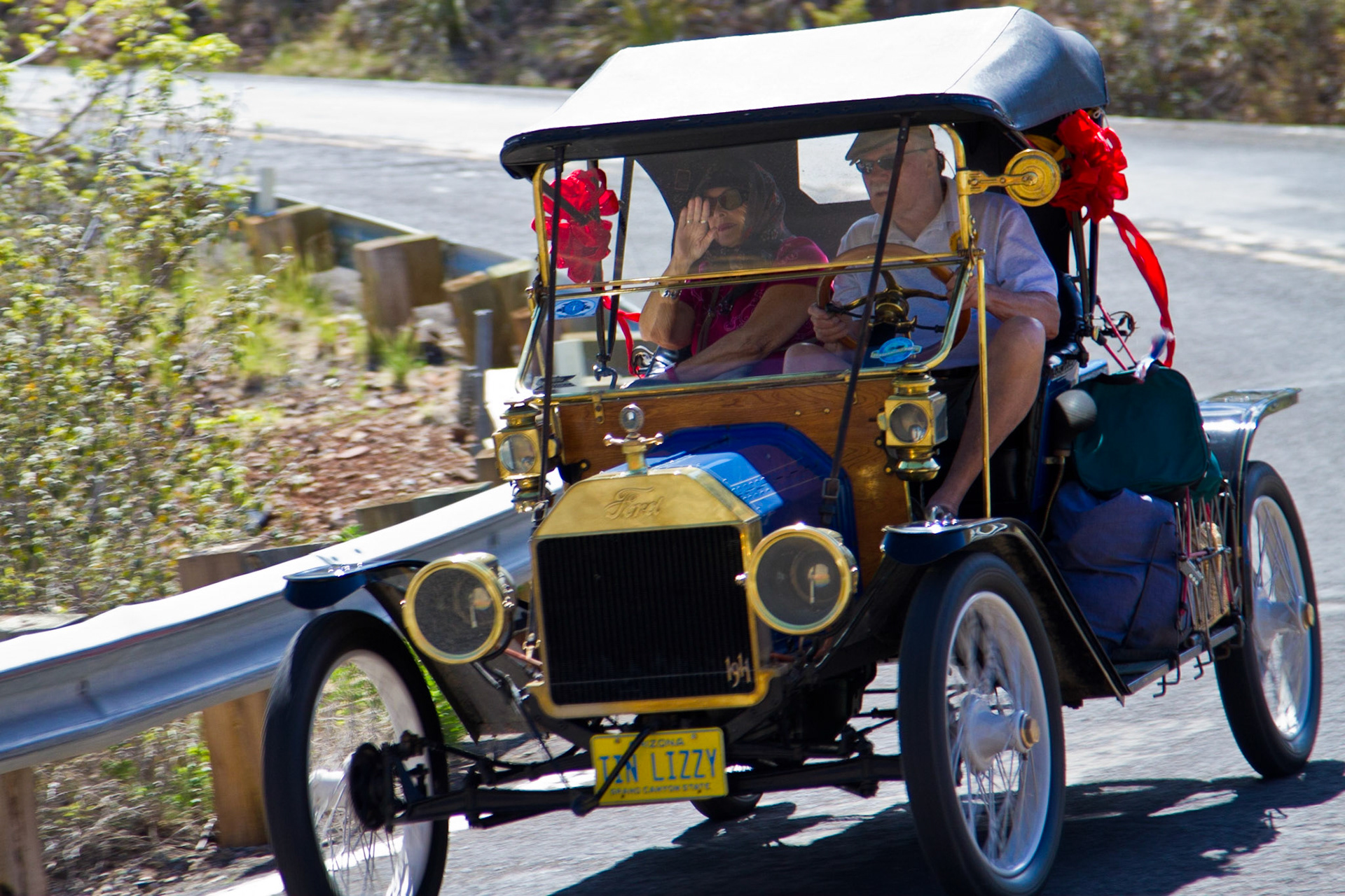
1911 Model T Ford near Jerome, AZ
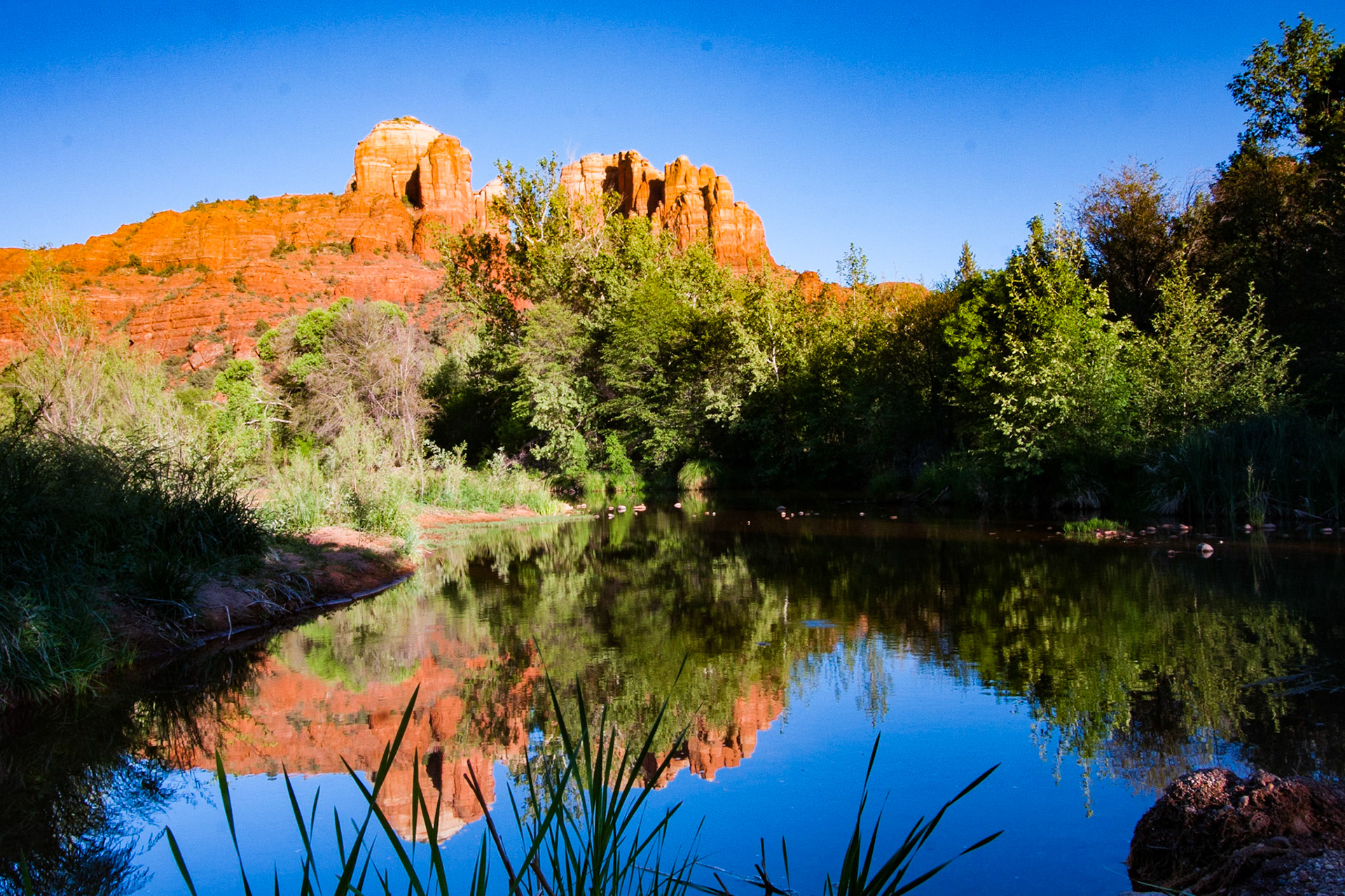
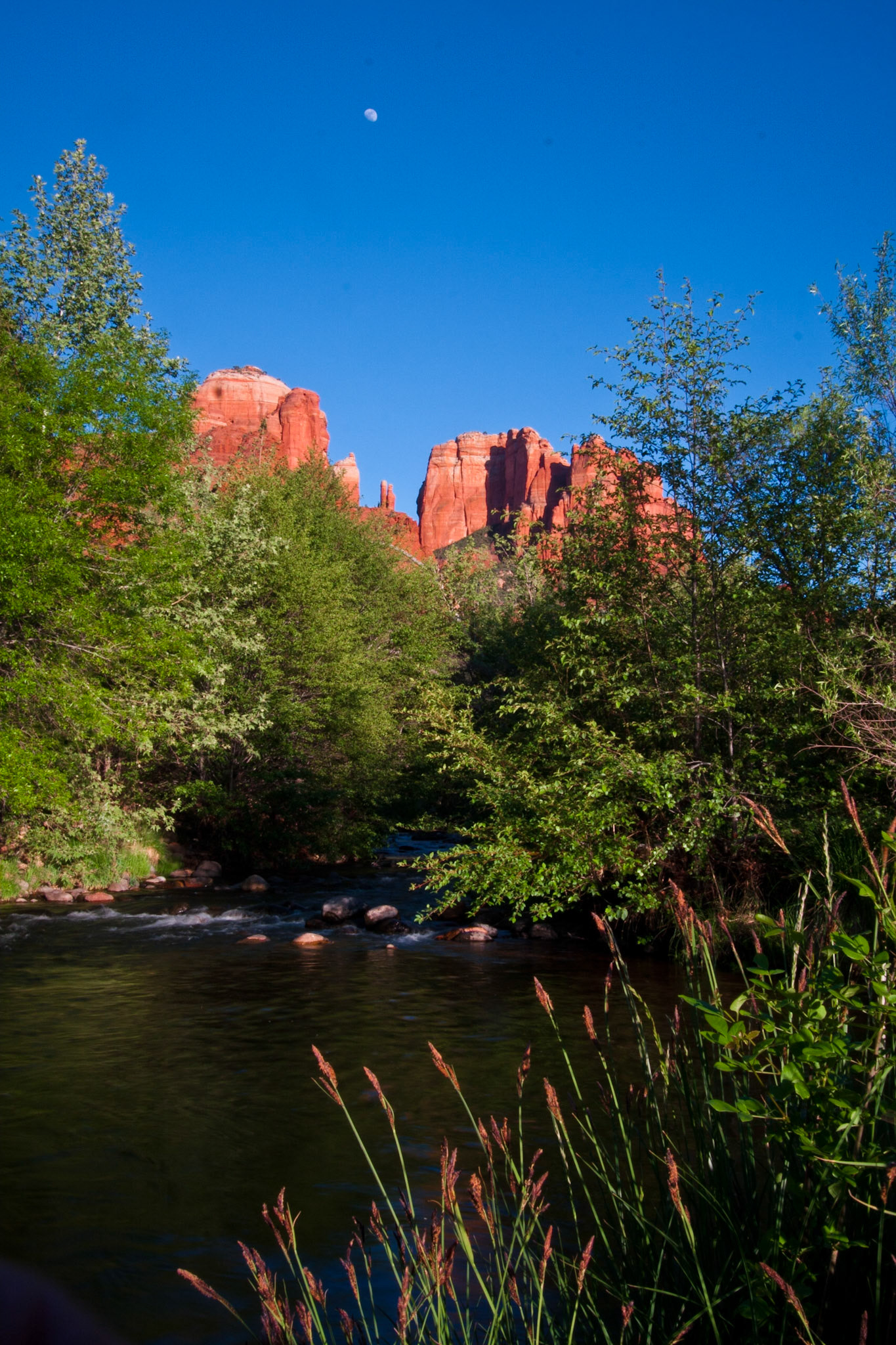
Cathederal Peak, Sedona from Crescant Moon Ranch Park
Cathederal Peak, Sedona from Crescant Moon Ranch Park
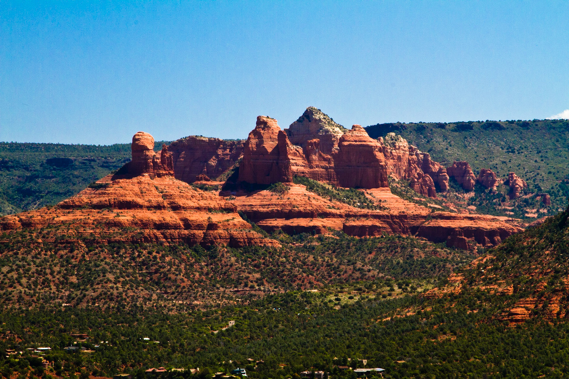
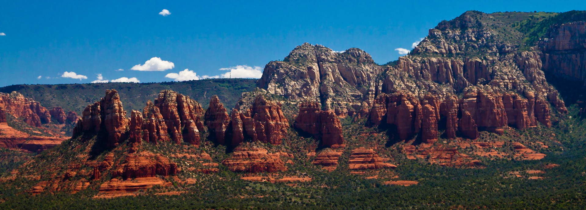
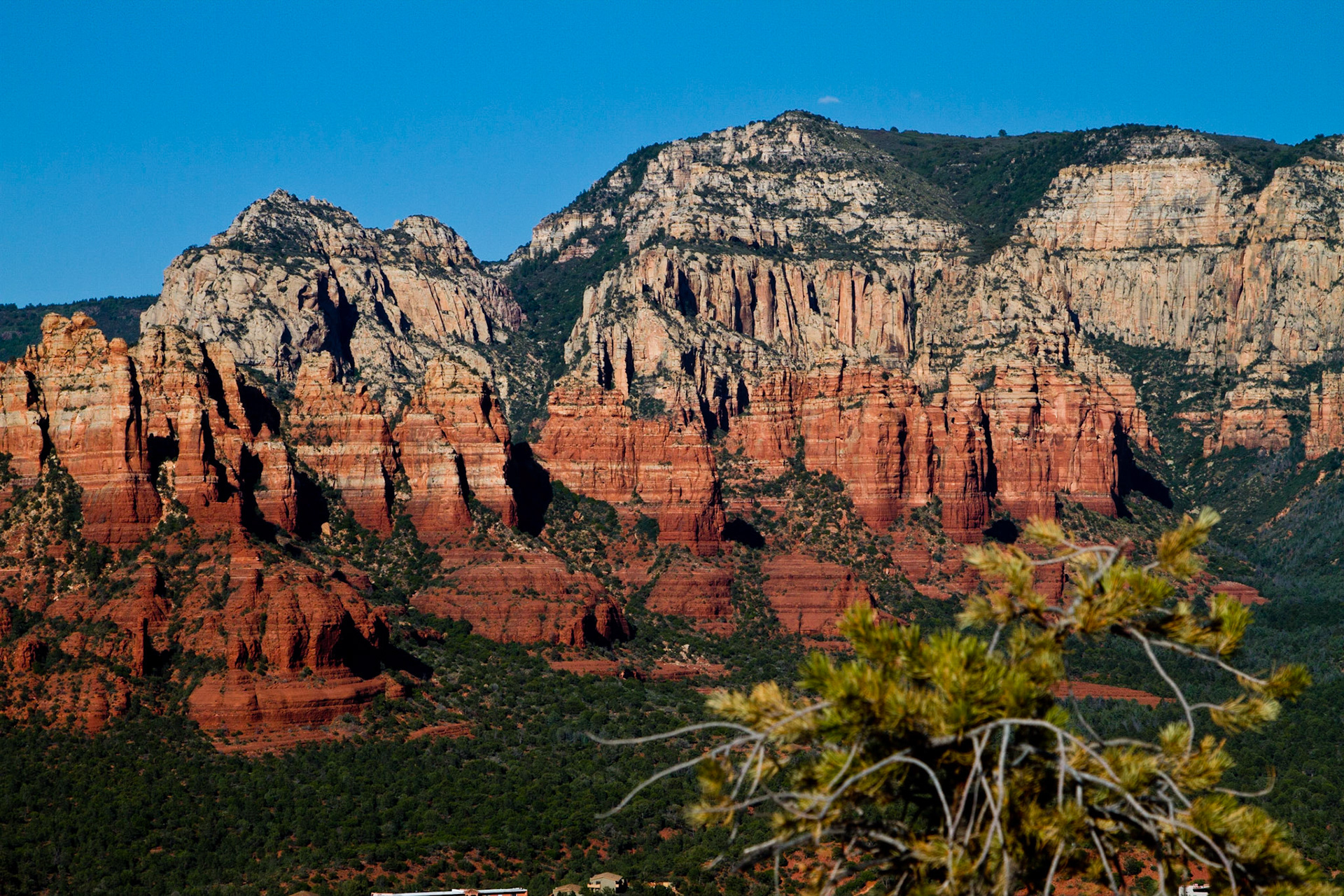
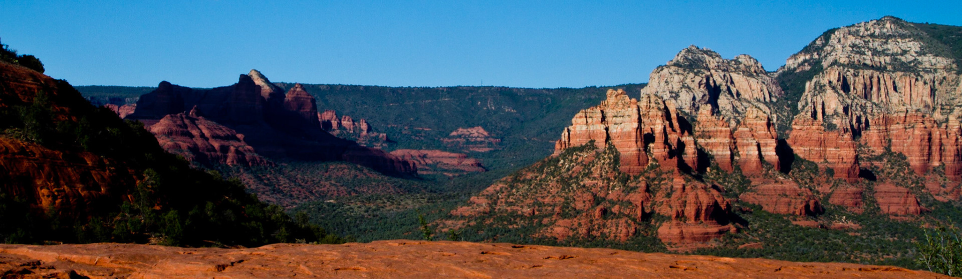
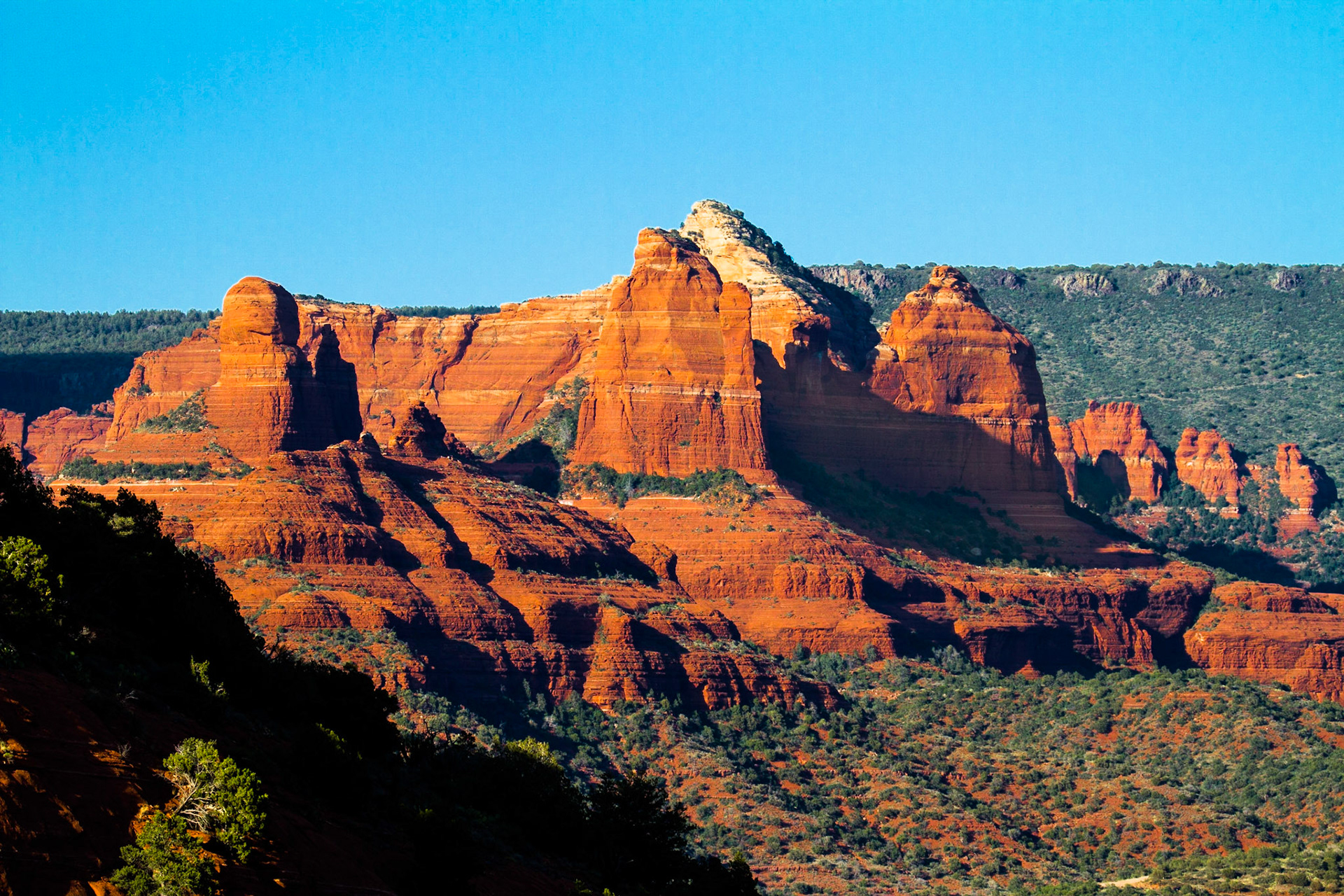
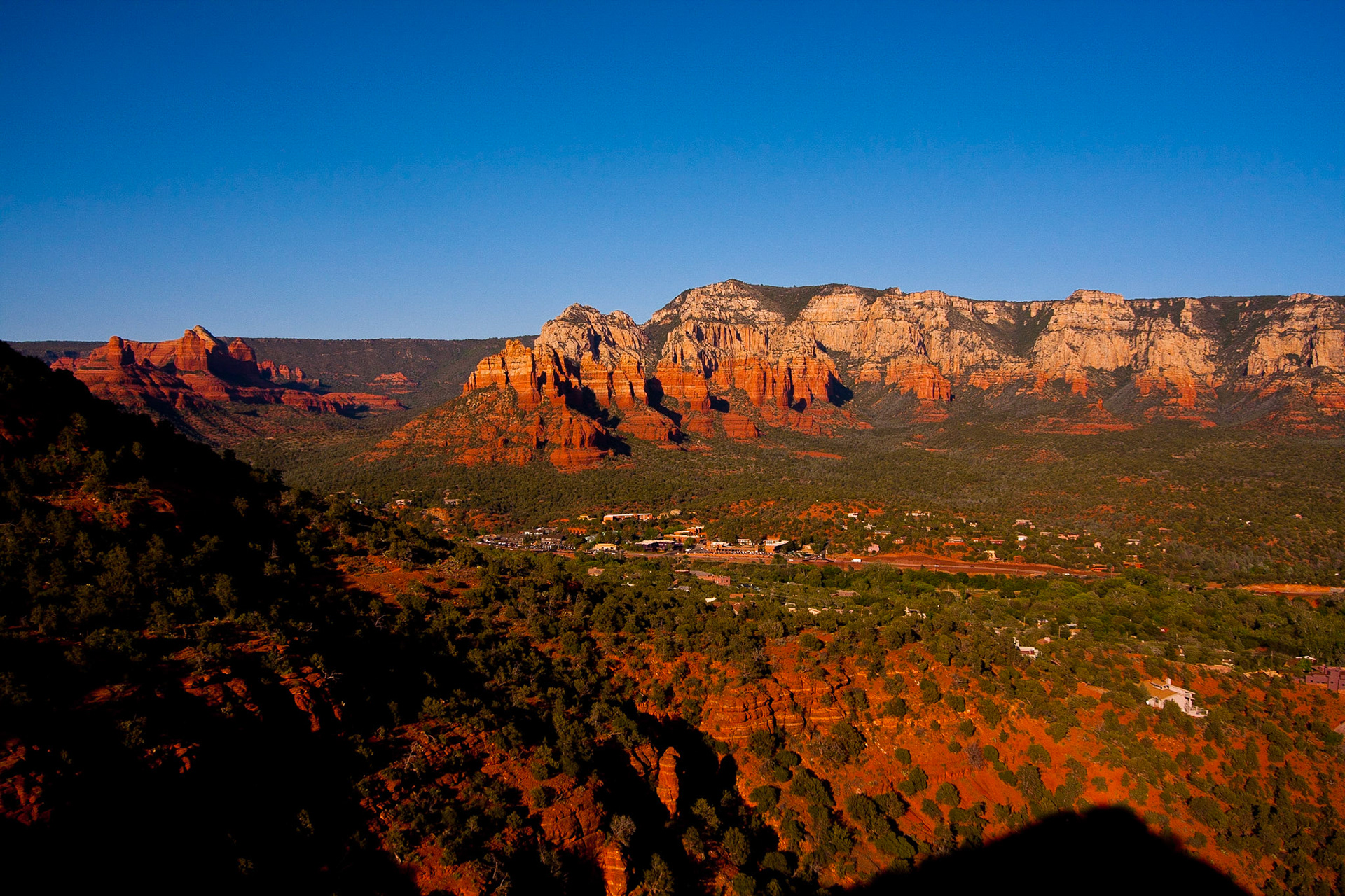
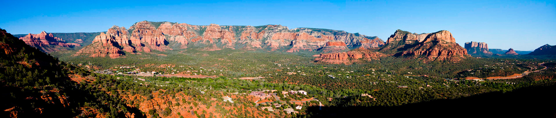
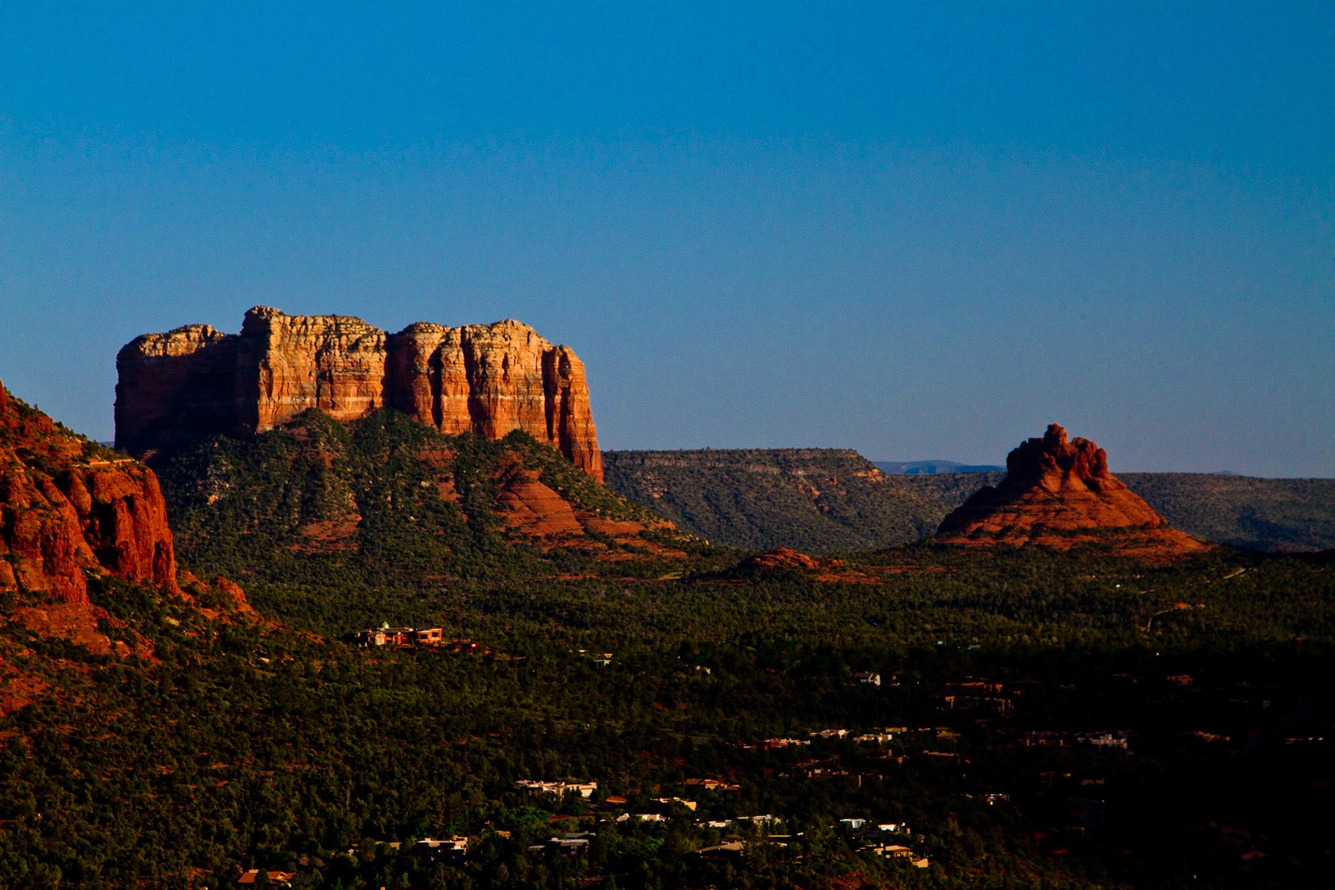
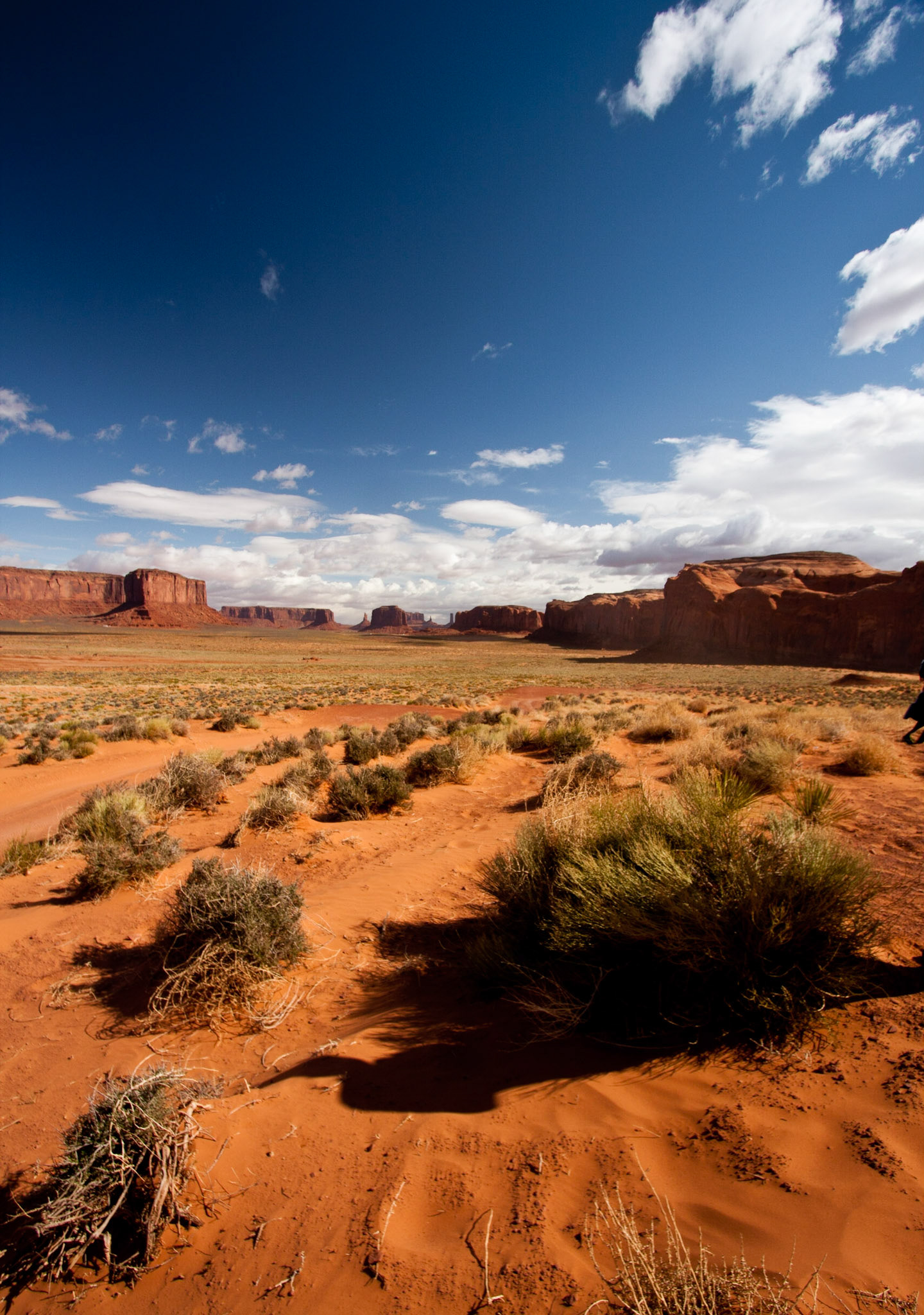
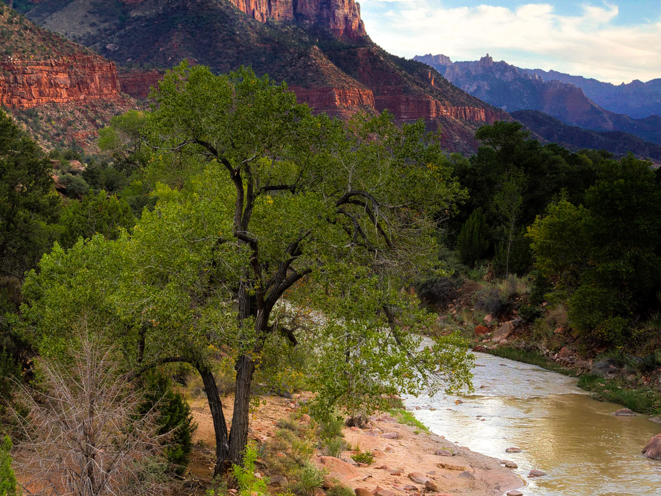
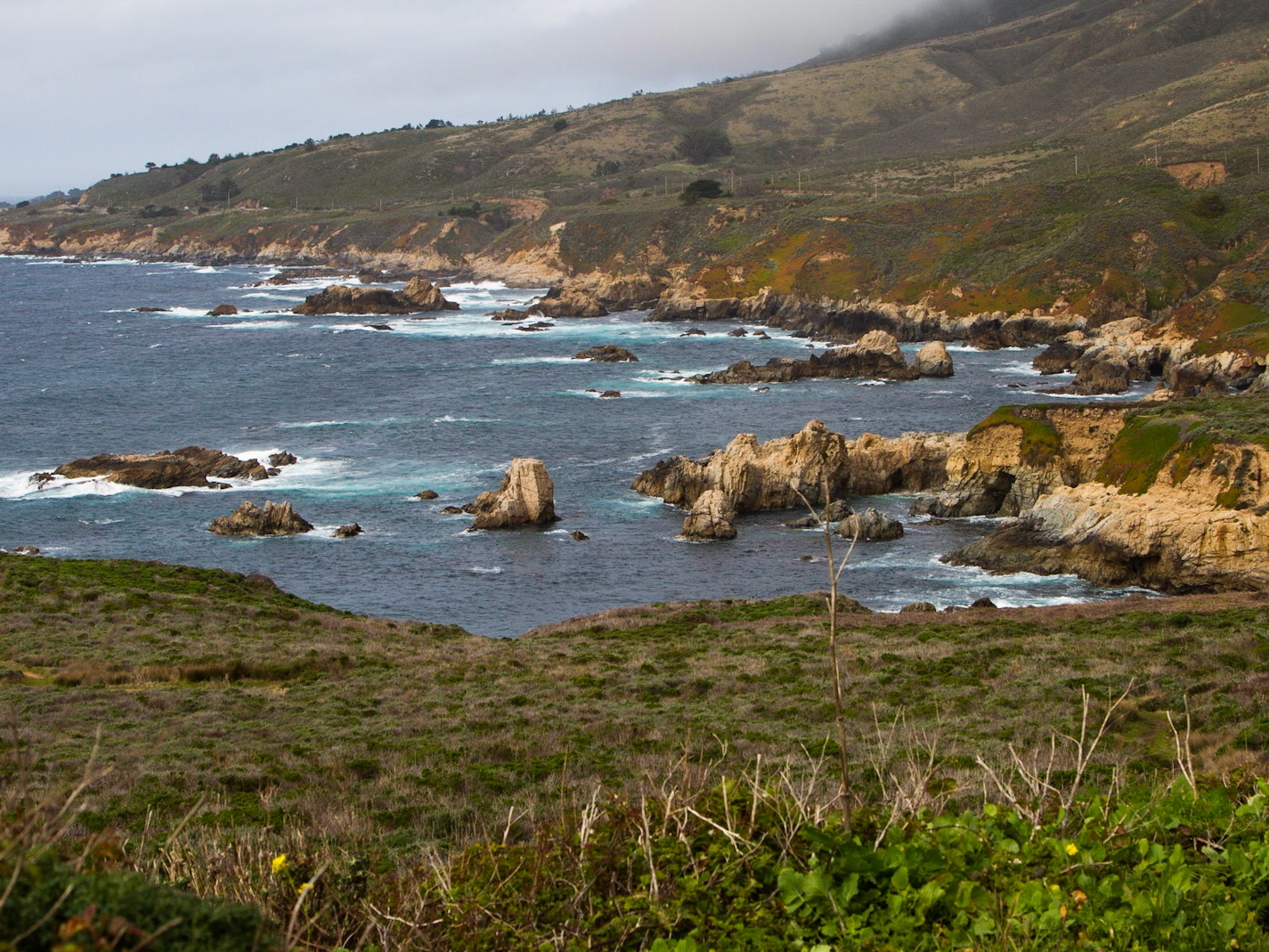
From Sedona Airport Rd, lower overlook
From Sedona Airport Rd, lower overlook
From Sedona Airport Rd, lower overlook
From Sedona Airport Rd, lower overlook
From Sedona Airport Rd, lower overlook
From Sedona Airport Rd, lower overlook
From Sedona Airport Rd, lower overlook
My view of the scenic American Soutwest.
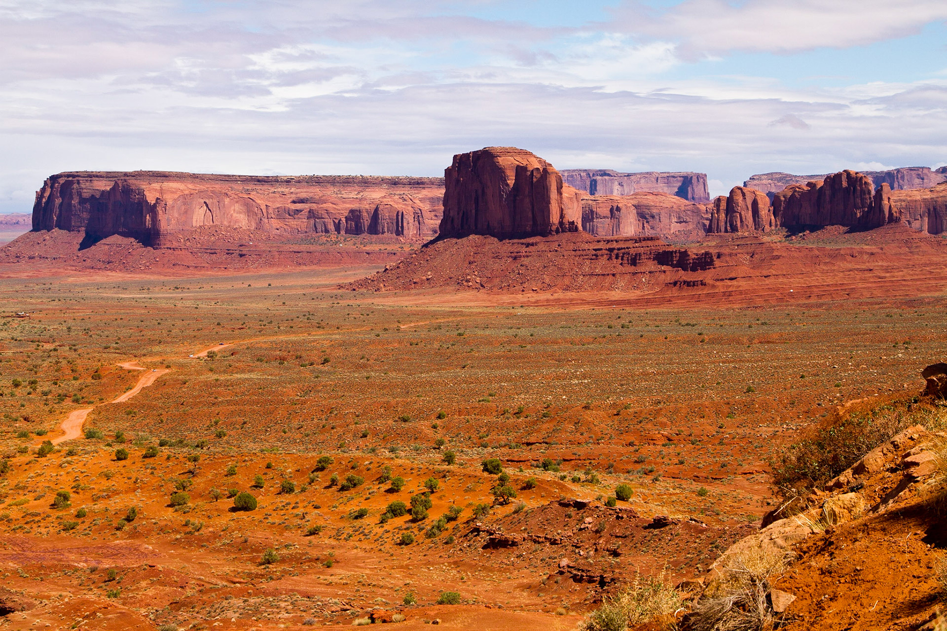
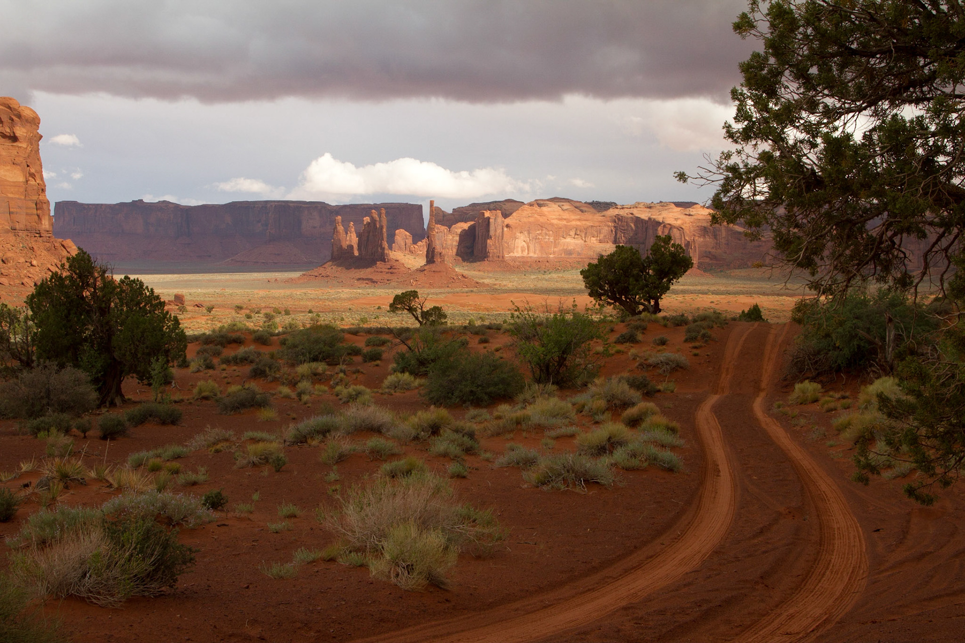
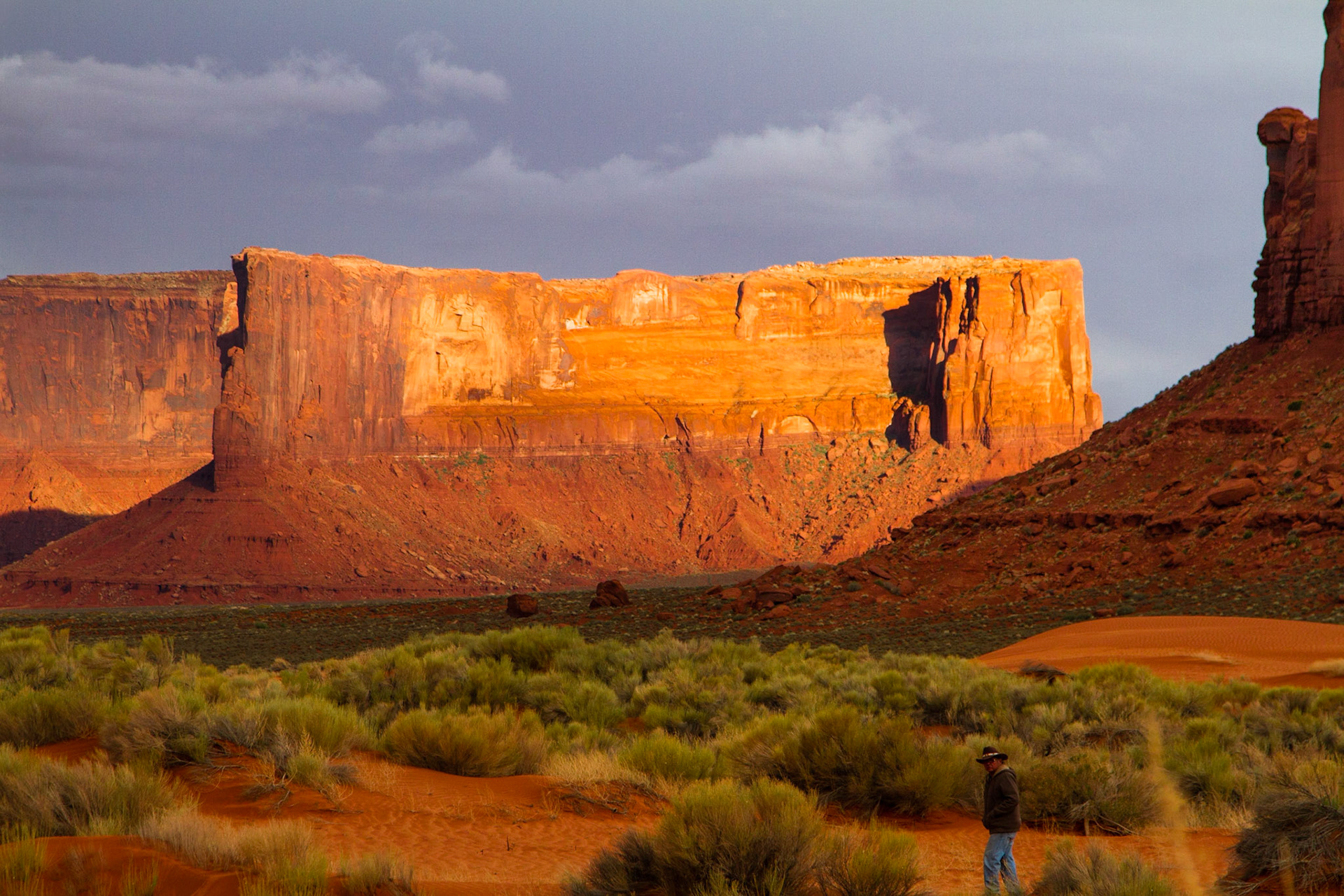
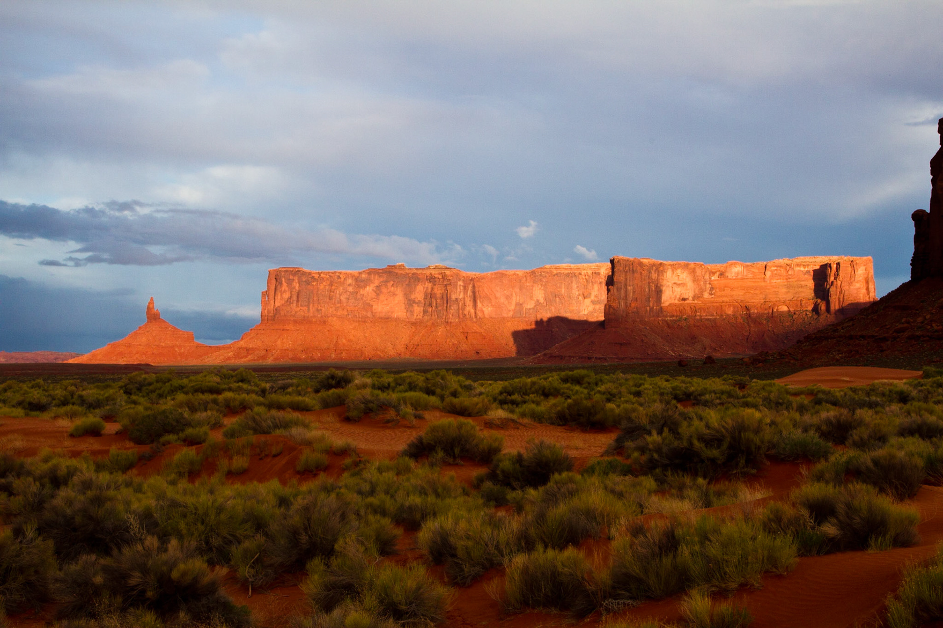
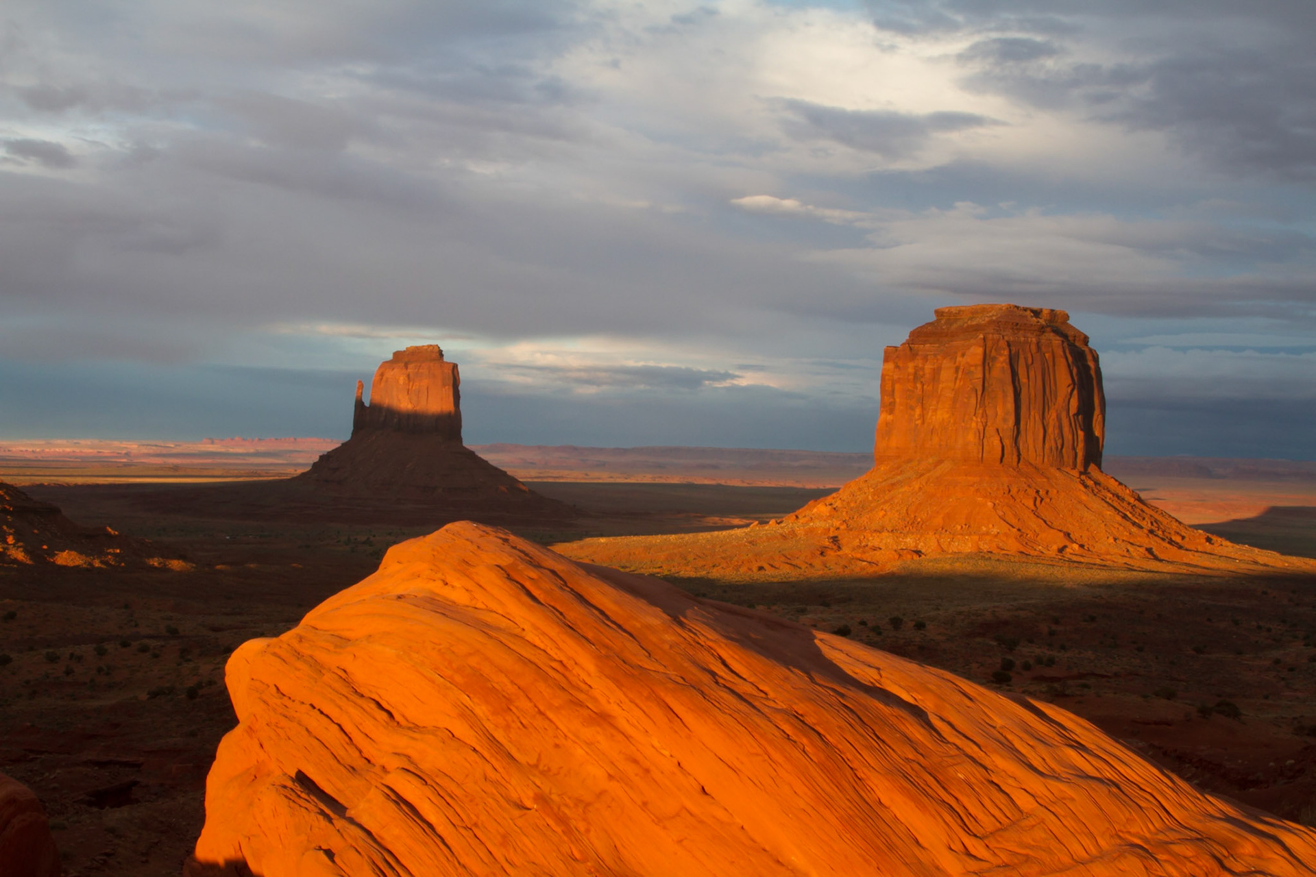
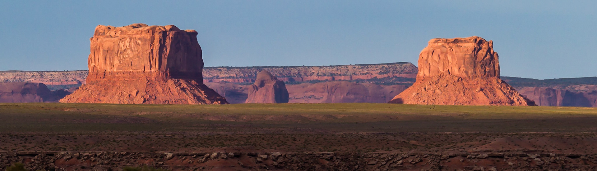
Monument Valley, AZ
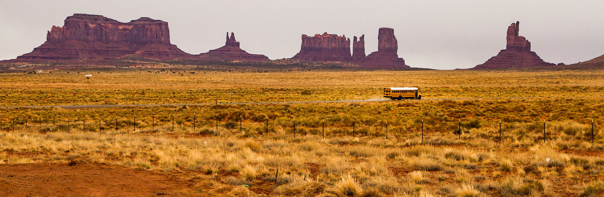
Off to school in Monument Valley
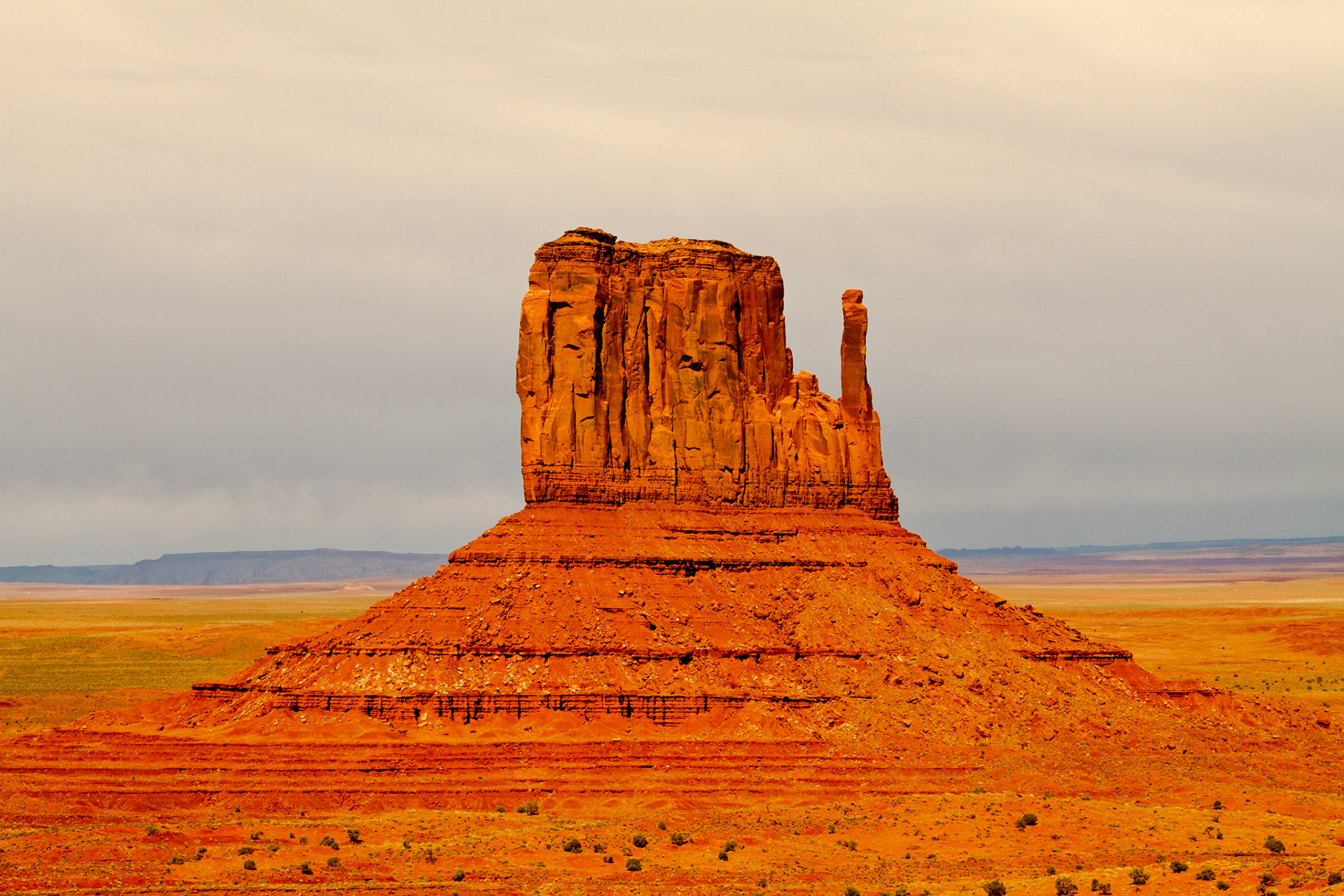
West Mitten Butte, Monument Valley
Monument Valley, AZ
Totem Pole & Yei Bi Chei, Monument Valley
Monument Valley, AZ
Monument Valley, AZ
Monument Valley is part of the Colorado Plateau characterized by a cluster of vast sandstone buttes, the largest reaching 1,000 ft above the valley floor. It is located on the Arizona-Utah state line near the Four Corners and lies within the Navajo Nation Reservation and is designated a Navajo Tribal Park.
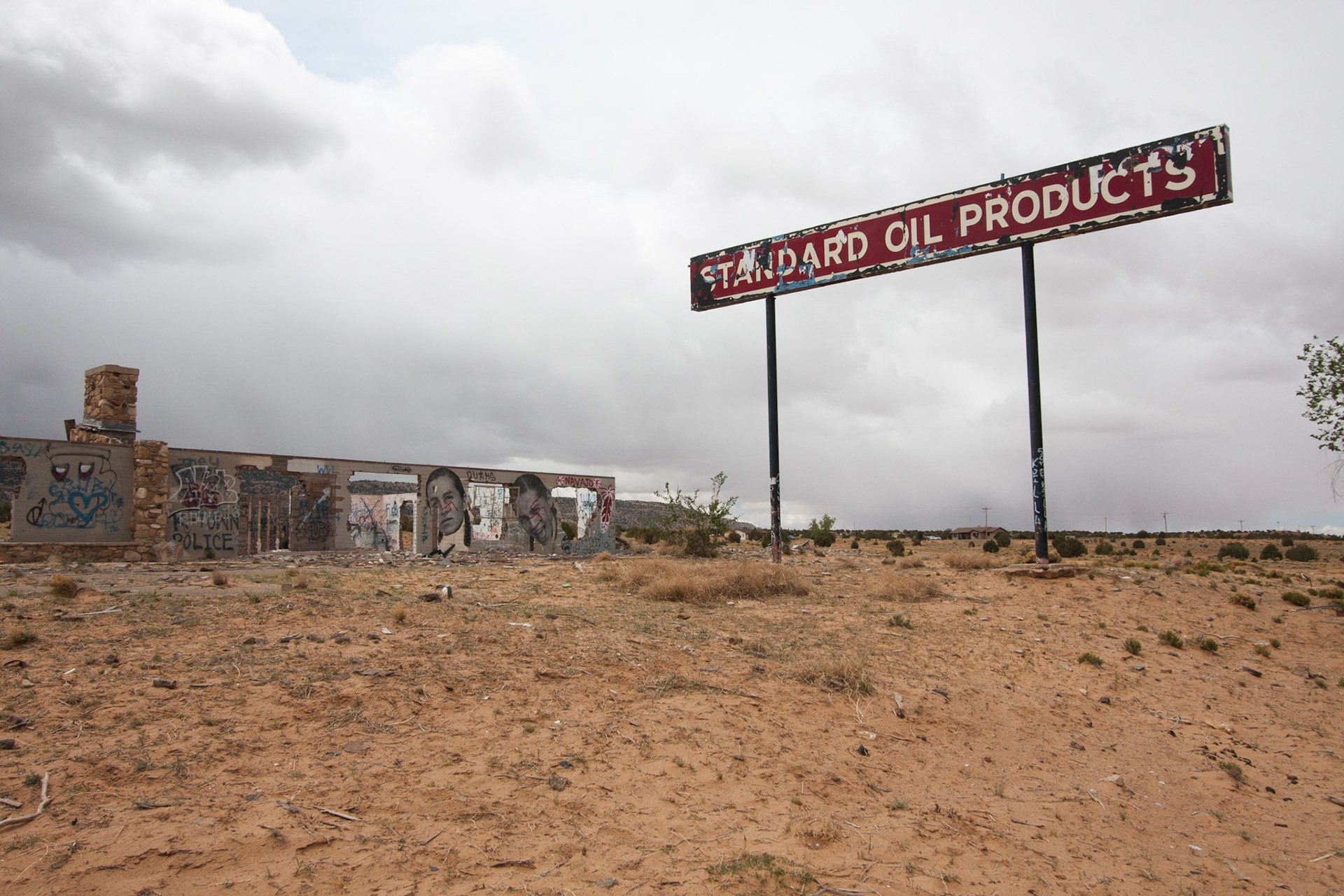
Standard Oil
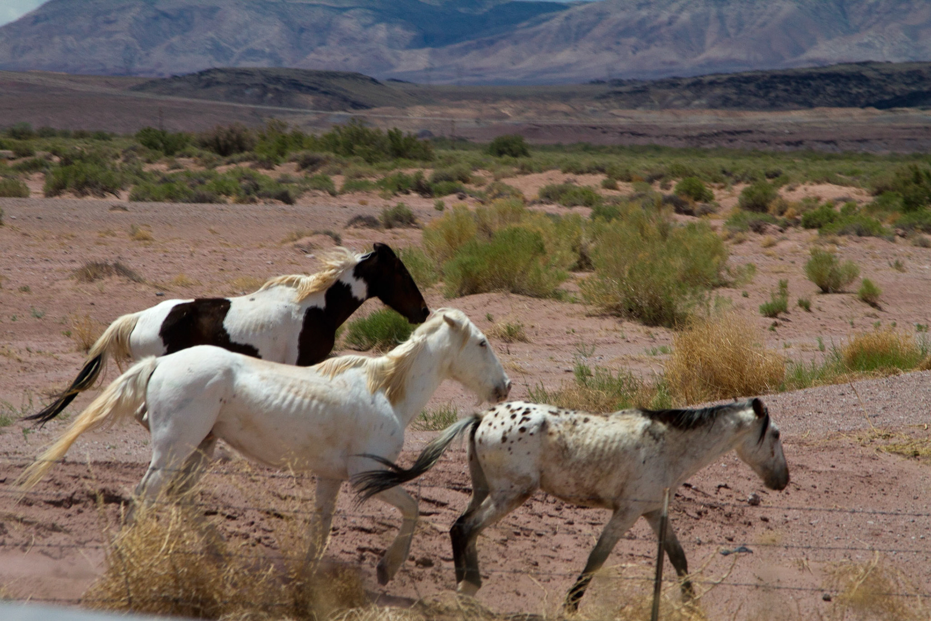
Horses in Arizona
From Sedona Airport Rd, lower overlook
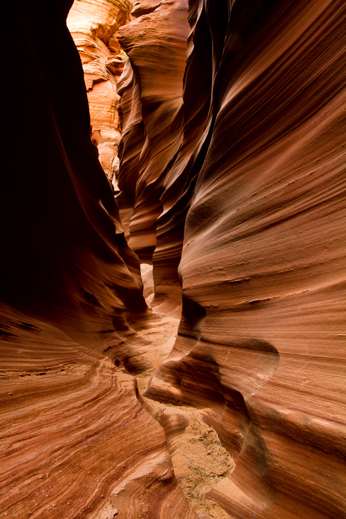
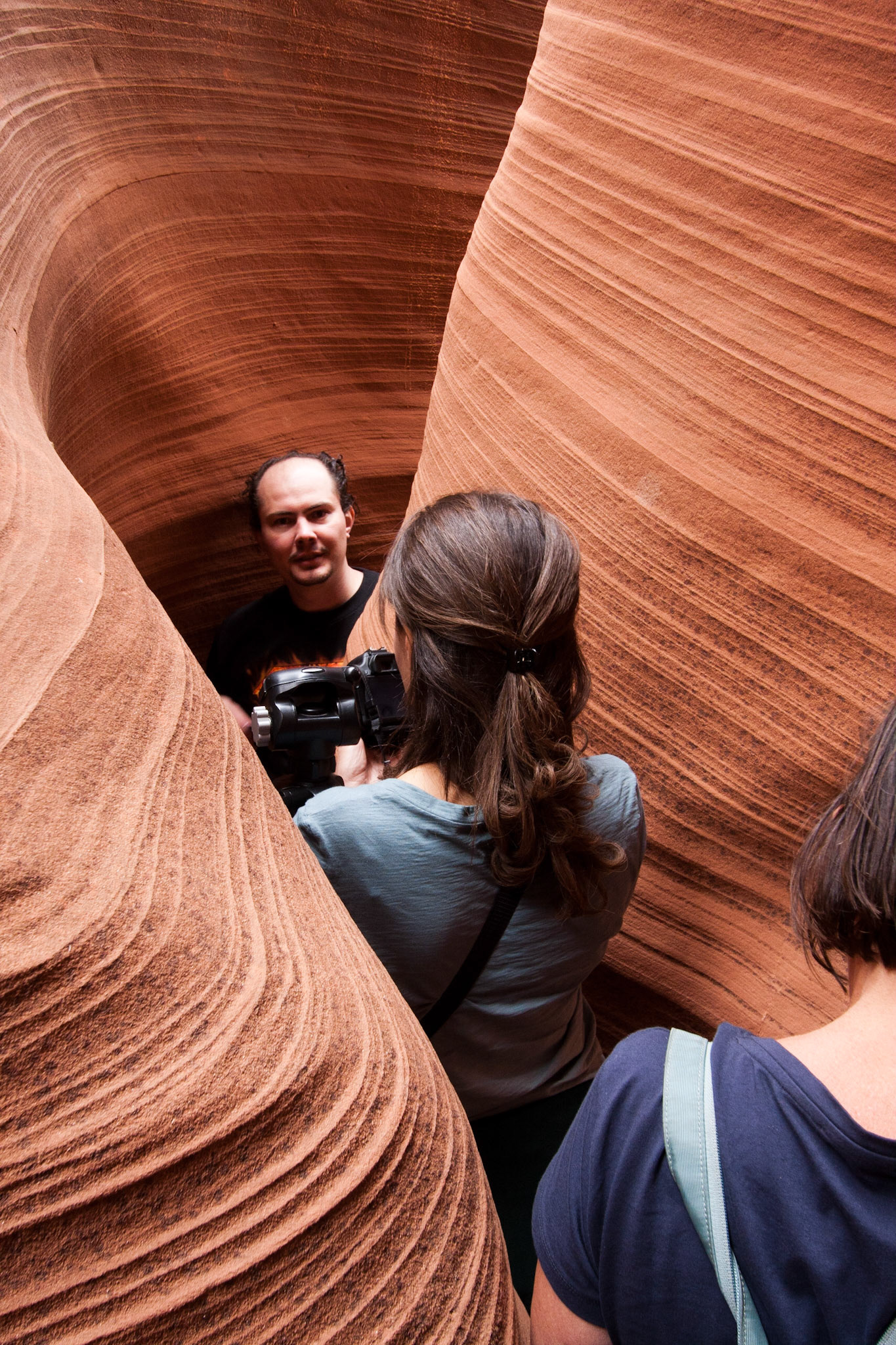
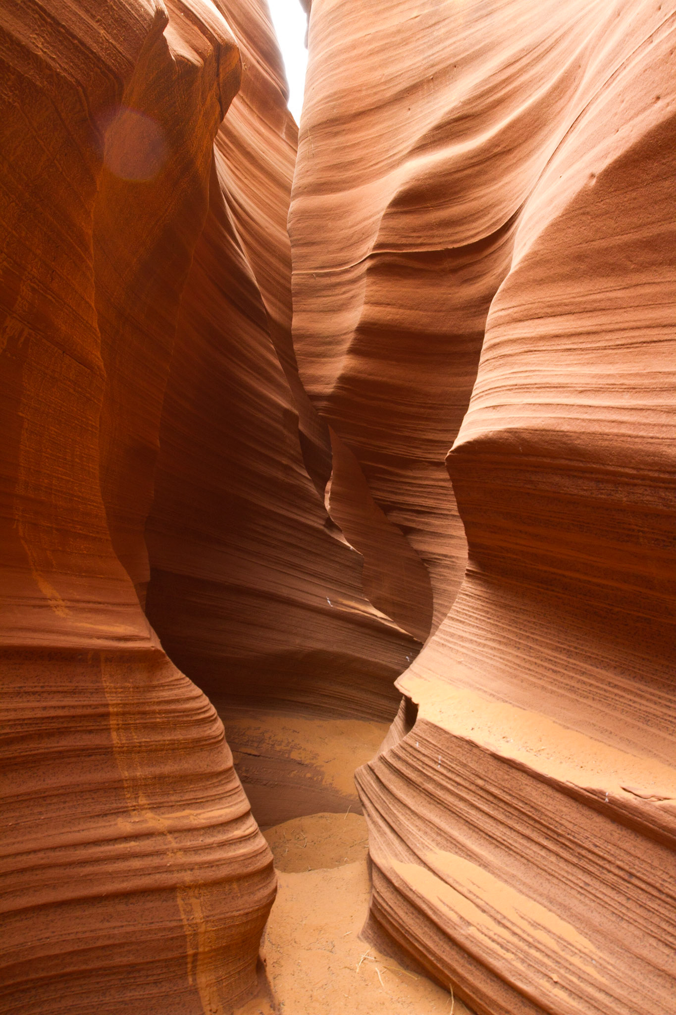
Narrow section of Rattle Snake Slot Canyon, Page, AZ
Narrow section of Rattle Snake Slot Canyon, Page, AZ
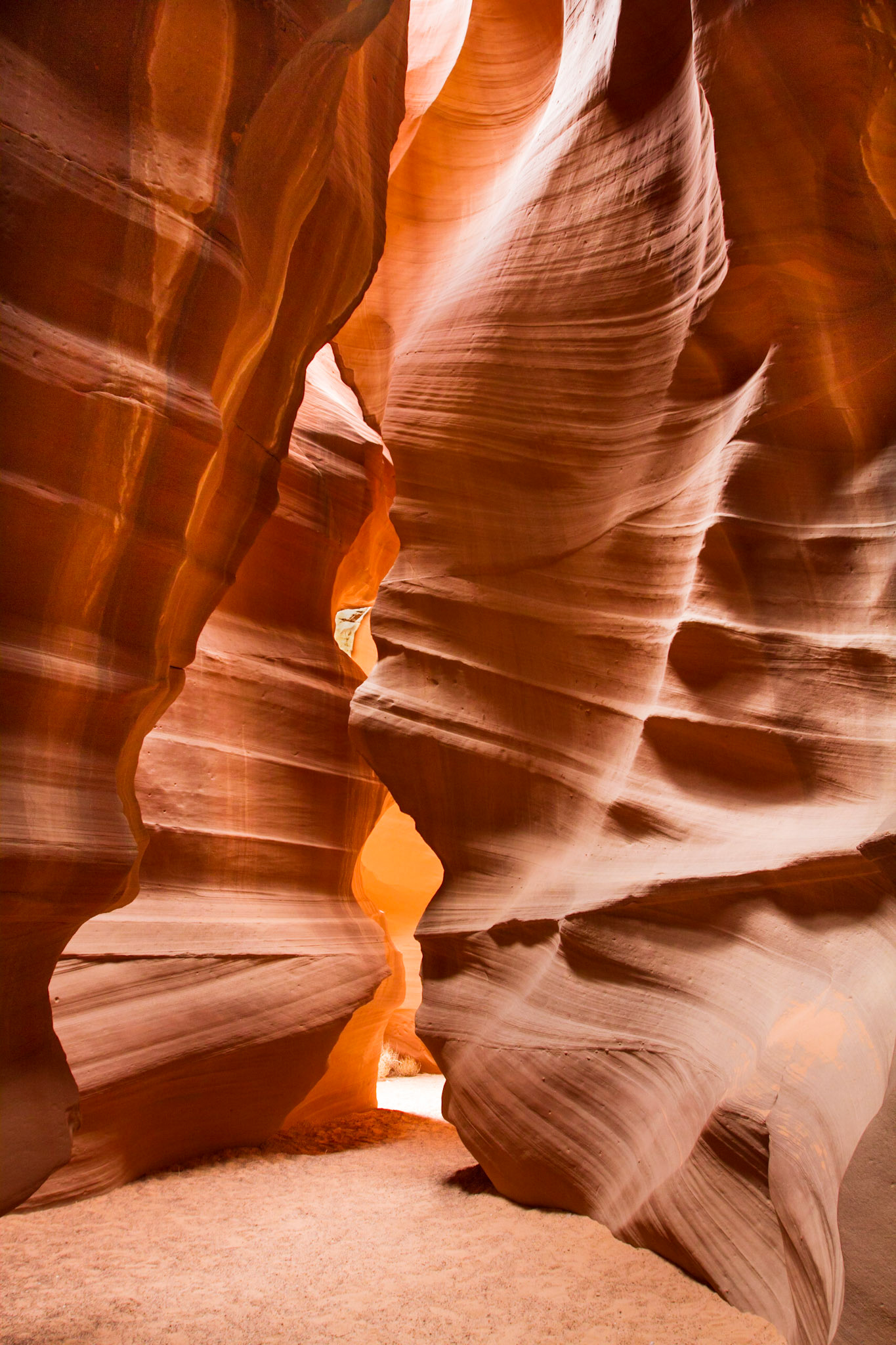
Upper Antelope Canyon is located on Navajo land near Page, Arizona within the LeChee Chapter of the Navajo Nation. Antelope Canyon includes two separate, slot canyon sections – one on either side of Route AZ98 a few miles East of Page. These canyons are referred to individually as Upper Antelope Canyon or The Crack; and Lower Antelope Canyon or The Corkscrew.The Navajo name for Upper Antelope Canyon is Tsé bighánílíní, which means "the place where water runs through rocks" and water is what created the canyons as it flowed through and eroded the Navajo Sandstone. This primarily happens during flash flooding. Rainwater, especially during monsoon season, runs into the extensive basin above the slot canyon sections, picking up speed and sand as it rushes into the narrow passageways. Over time the passageways are eroded away, making the corridors deeper and smoothing hard edges in such a way as to form characteristic 'flowing' shapes in the rock.Flooding in the canyon still occurs. A flood occurred on October 30, 2006 that lasted 36 hours, and caused the Tribal Park Authorities to close Lower Antelope Canyon for five months.
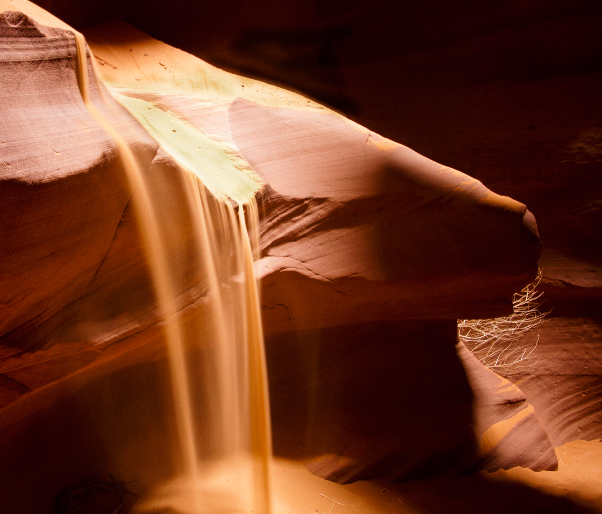
Sand Falling in Upper Antelope Slot Canyon, Page, AZ. During tours of the canyon guides toss sand onto the top of this rock and let it flow over the edge in as Sandfall. Upper Antelope Canyon is located on Navajo land near Page, Arizona within the LeChee Chapter of the Navajo Nation. Antelope Canyon includes two separate, slot canyon sections – one on either side of Route AZ98 a few miles East of Page. These canyons are referred to individually as Upper Antelope Canyon or The Crack; and Lower Antelope Canyon or The Corkscrew.The Navajo name for Upper Antelope Canyon is Tsé bighánílíní, which means "the place where water runs through rocks" and water is what created the canyons as it flowed through and eroded the Navajo Sandstone. This primarily happens during flash flooding. Rainwater, especially during monsoon season, runs into the extensive basin above the slot canyon sections, picking up speed and sand as it rushes into the narrow passageways. Over time the passageways are eroded away, making the corridors deeper and smoothing hard edges in such a way as to form characteristic 'flowing' shapes in the rock.Flooding in the canyon still occurs. A flood occurred on October 30, 2006 that lasted 36 hours, and caused the Tribal Park Authorities to close Lower Antelope Canyon for five months.
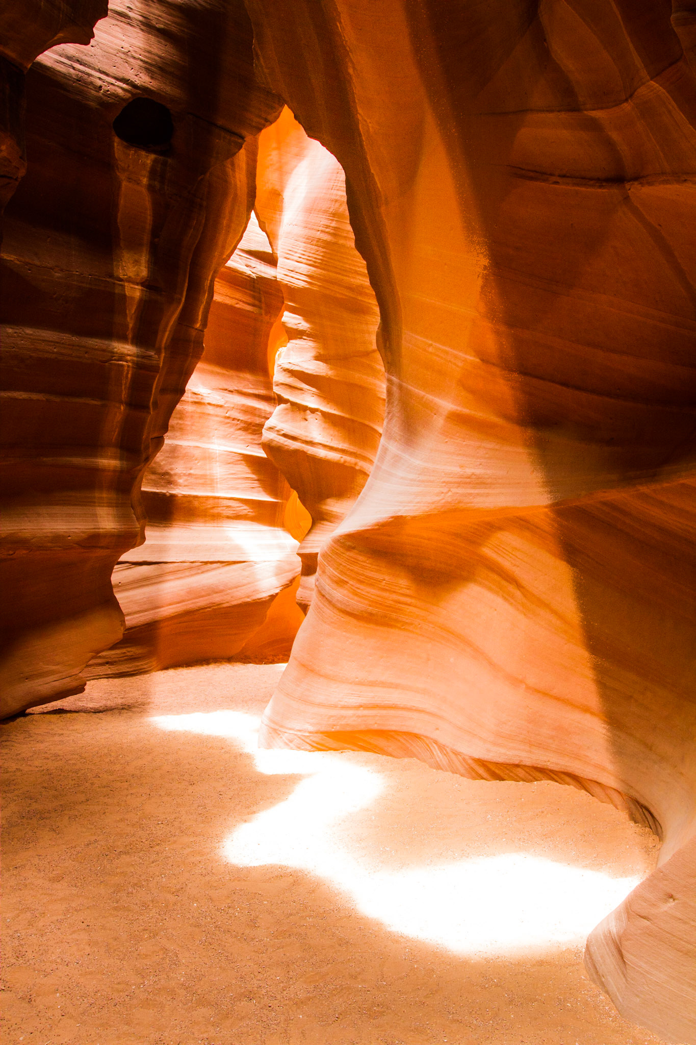
At Antelope Canyon in Page, AZ there are actually dozens of similar slot canyons, the most famous of which is Upper Antelope Canyon. This canyon can get quite crowded in late morning when the famous "Light Beam" comes along and after throwing dust in the air you can see the narrow shaft of light descending to the canyon floor.This shot was also in Upper Antelope Canyon but is not the standard light beam one usually sees. The day I was in the canyon the famous light beam didn't materialize due to cloud cover. However an hour later, after most of the disappointed other photographers had left, in another part of the same canyon, I found this interesting sun pattern on the floor. While not a column of light like the “Beam” it is more an abstract shape that echoes the shape of the canyon walls (which of course is what makes the shape in the first place).
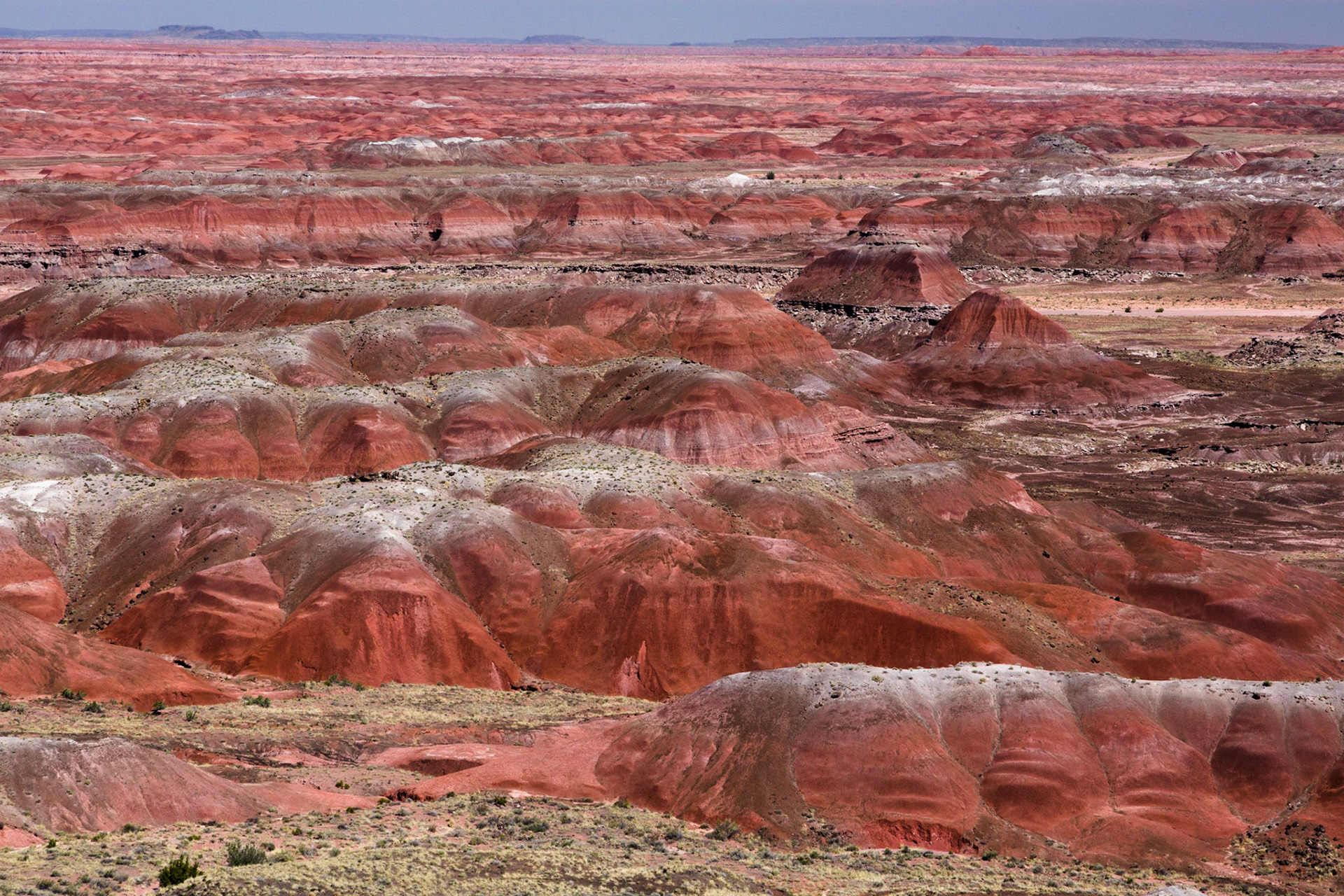
This is a section of the Painted Desert from the Kochina Point overlook at the North end of the Painted Desert - Petrified Forest National Park in Arizona.
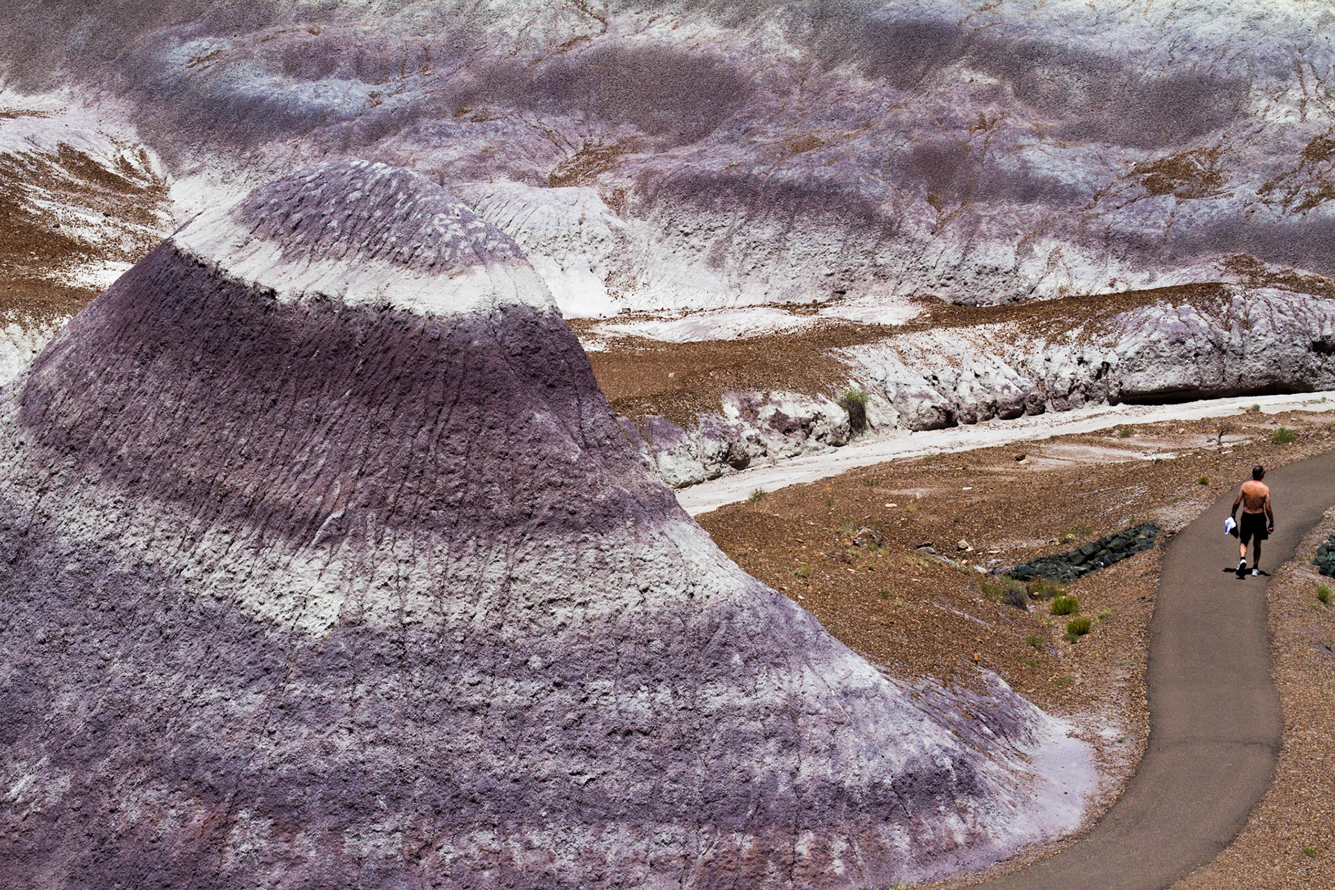
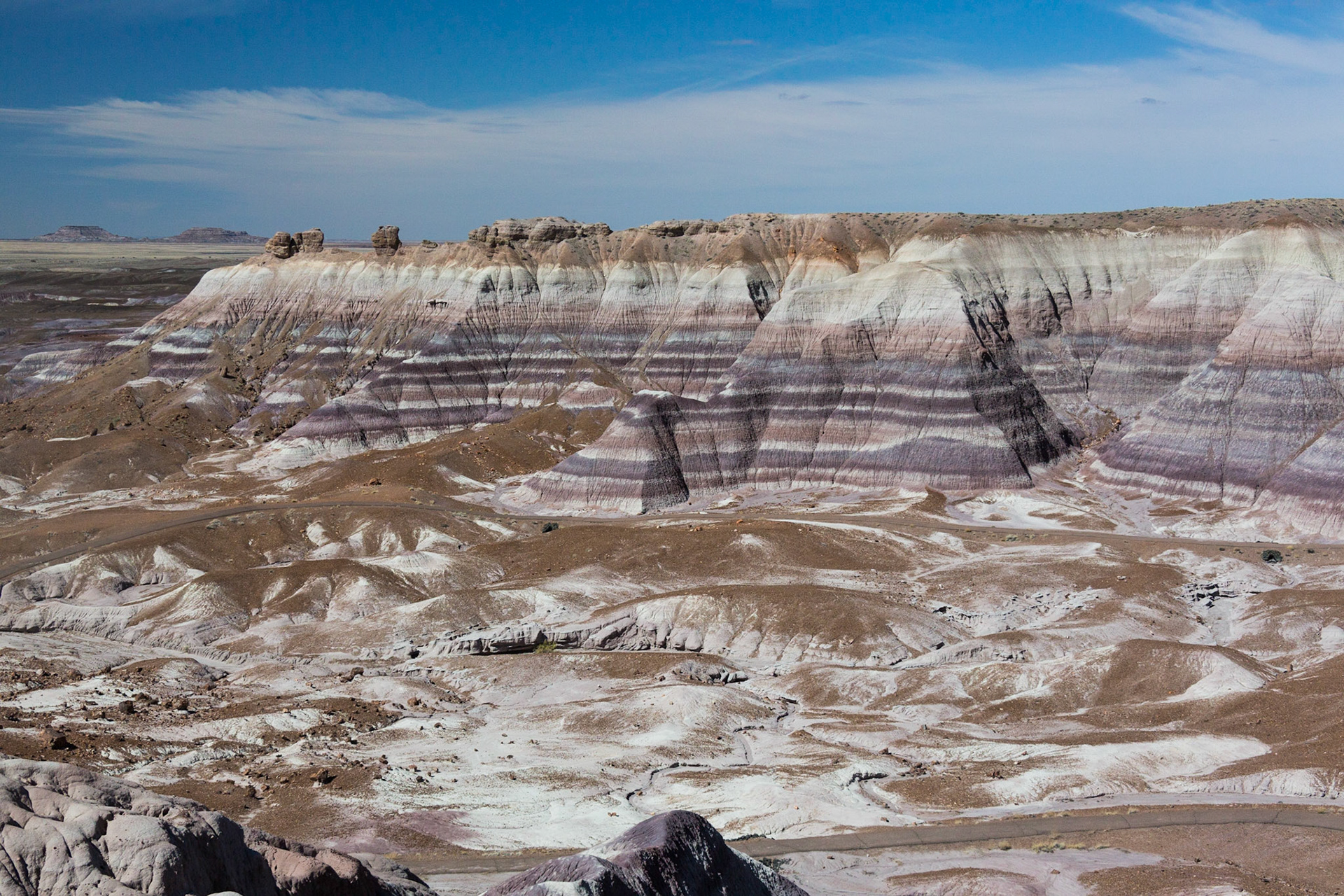
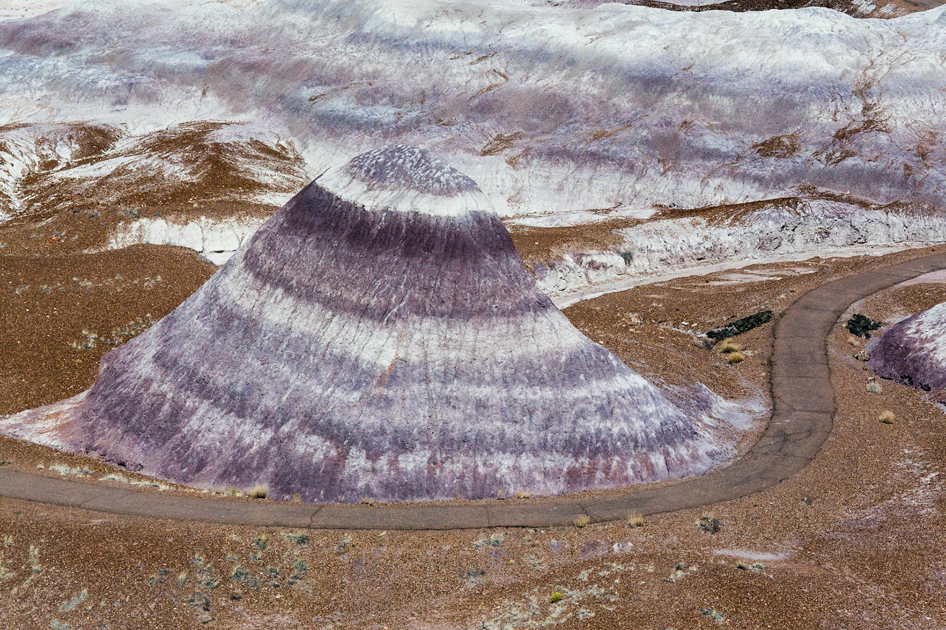
The painted desert in Arizona takes on many different color pallets in different areas. Most we are used to seeing show mostly reds and yellows. This section which is the Blue Mesa area of the Painted Desert - Petrified Forest National Park shows blue, purple, and gray tones.
Butts near Round Rock AZ
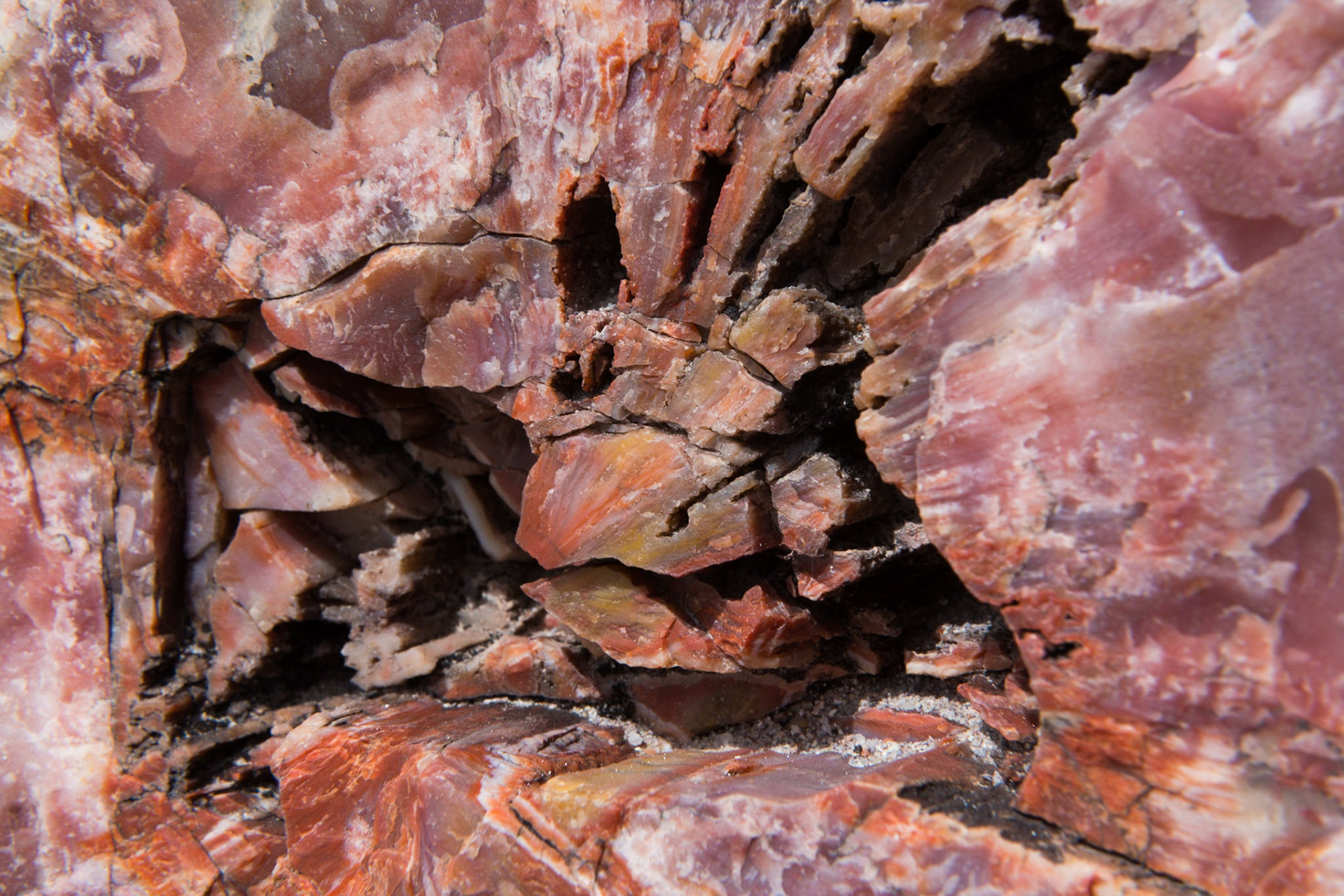
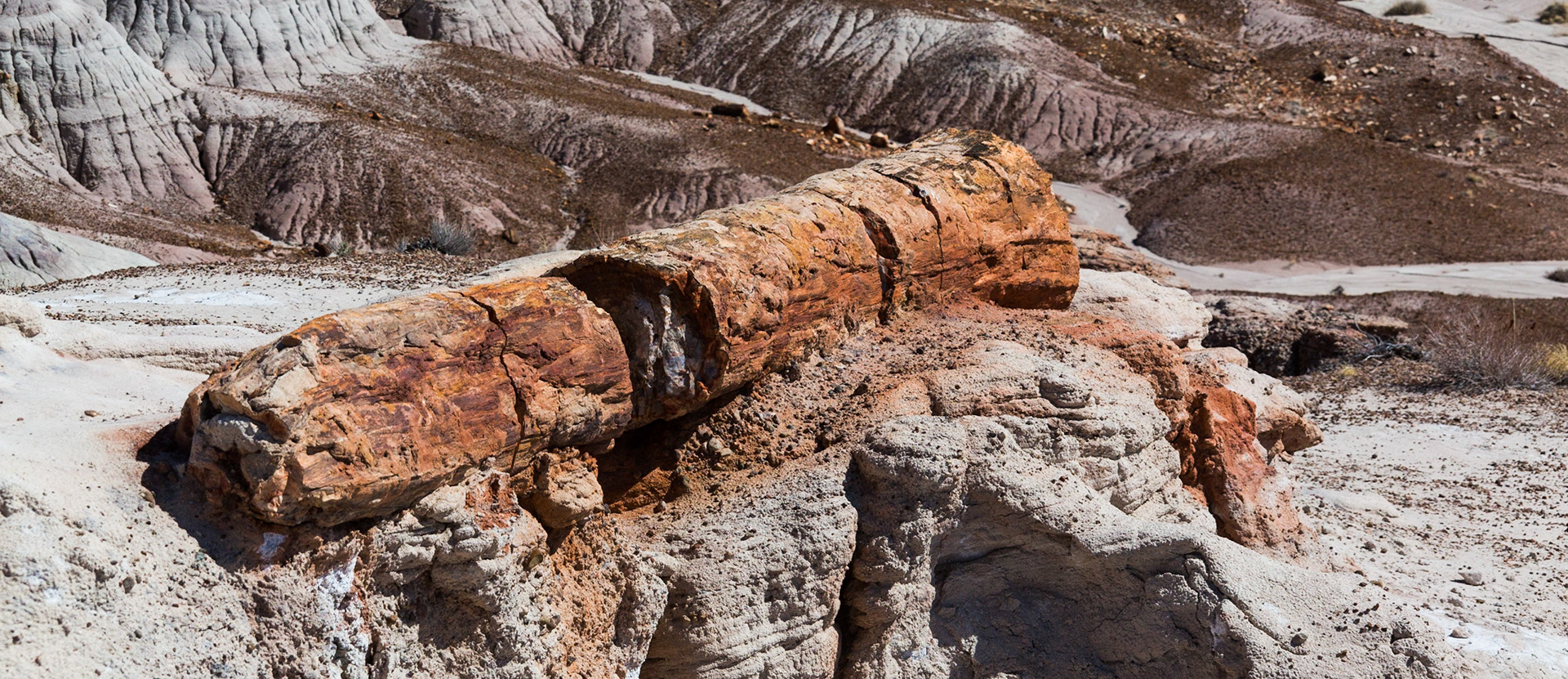
Petrified log cross section, Giant Log Trail, Painted Desert-Petrified Forest National Park, AZ. After these trees fell they were quickly covered in mud. Perhaps a massive flood is what toppled them in the first place, then carried them downstream where they formed a log jam and the flood quickly covered them with mud. As time went on, minerals from the mud gradually repaced the organic material. Different colors from from different minerals.
Two Butte's near Round Rock Arizona. Driving between Needles CA (where CA meets AZ at the Colorado river east of Barstow) and Blanding UT (between Monument valley and Moab) we saw this off the side of the road. We were getting that pre-sunset golden Southwest light (around 5:30 in May) which turns the red rock on the buttes thjis amzaing rich red color. Had to walk a little ways across some scrub to a barb wire fence in order to shoot over it such that it did not clutter the shot, but was well wotth the effort.
The painted desert in Arizona takes on many different color pallets in different areas. Most we are used to seeing show mostly reds and yellows. This section which is the Blue Mesa area of the Painted Desert - Petrified Forest National Park shows blue, purple, and gray tones intermingled with brown "dirt" and whtie.
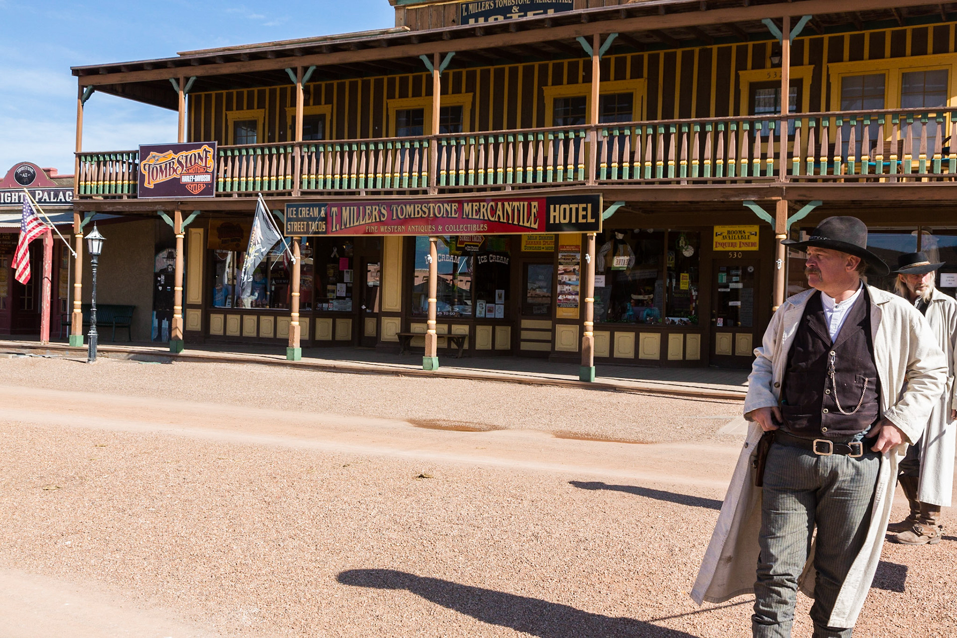
Drumming up business for "wstern" show, Historic main street, Tombstone, Arizona (3/2020)
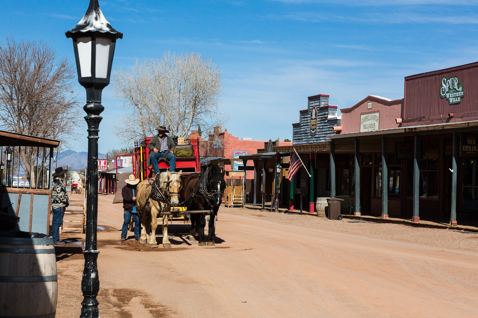
Stage coach, Historic main street, Tombstone, Arizona (3/2020)
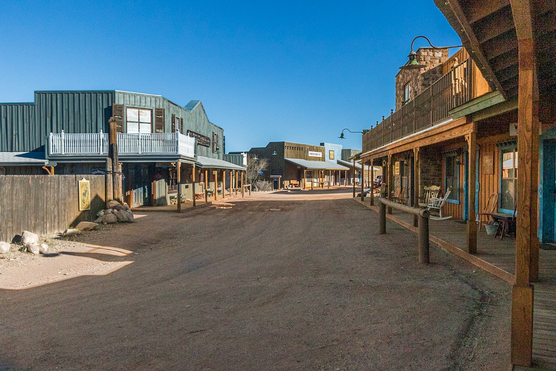
Guest rooms along recreation of western town. Tombstone Monument Guest Ranch, Tombstone AZ (3/2020)
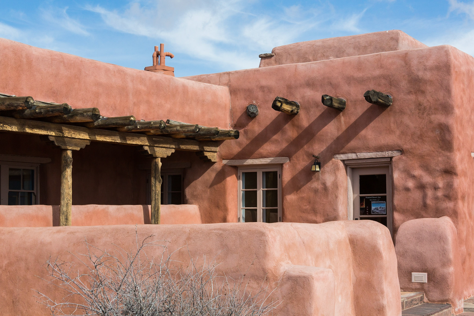
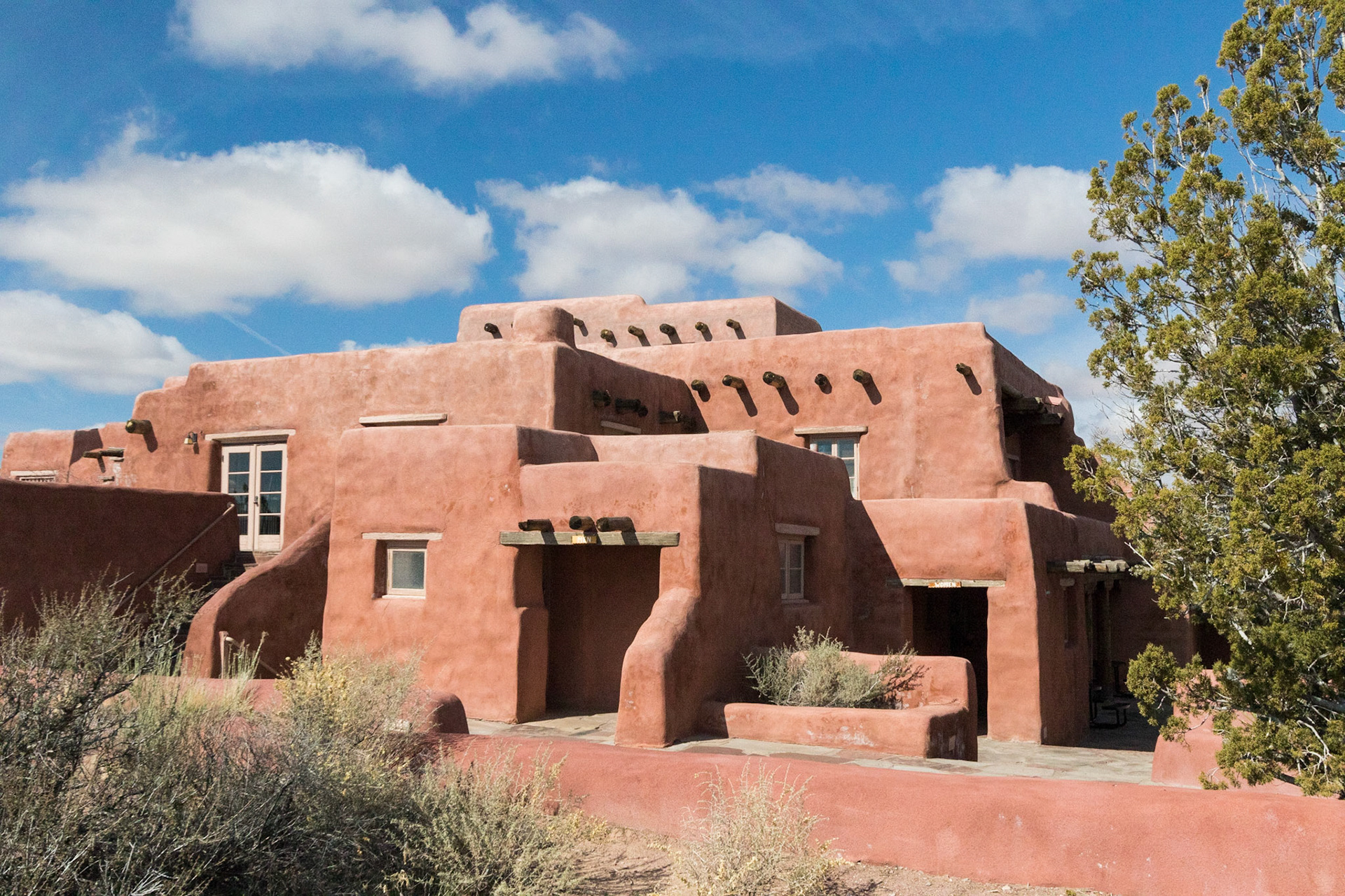
Painted Desert Inn, Painted Desert - Petrified Forest National Park, Arizona, USA (3/2020)
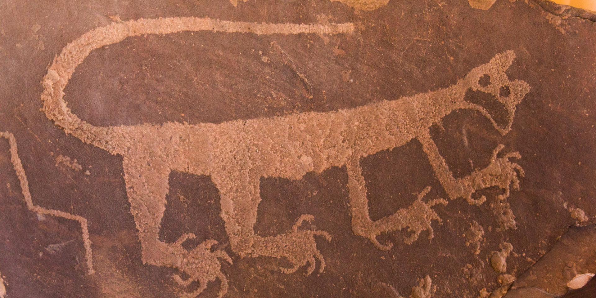
Petroglyph inside Painted Desert Inn, Painted Desert - Petrified Forest National Park, Arizona, USA (3/2020)
From Painted Desert Inn viewpoint, Painted Desert - Petrified Forest National Park, Arizona, USA (3/2020)
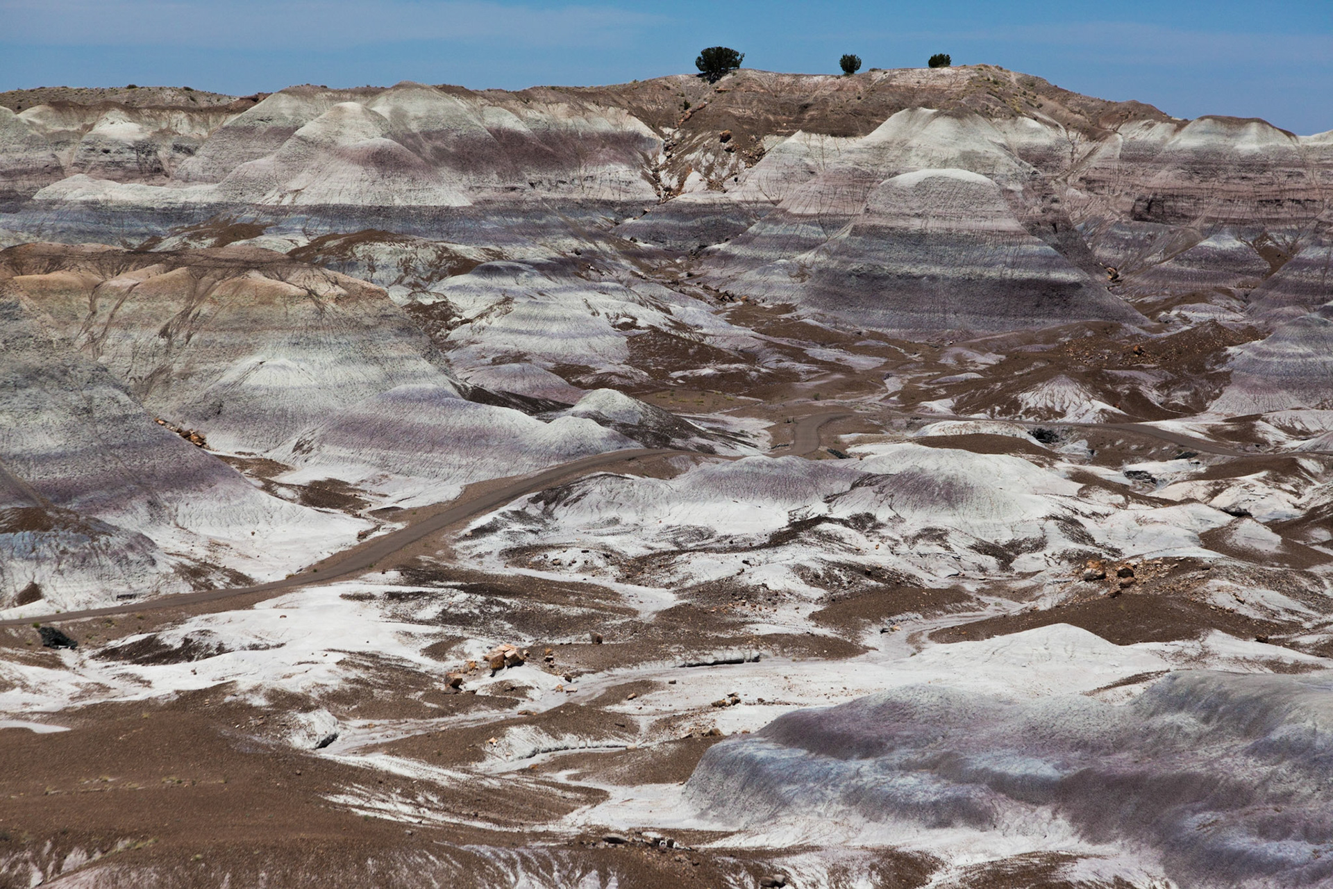
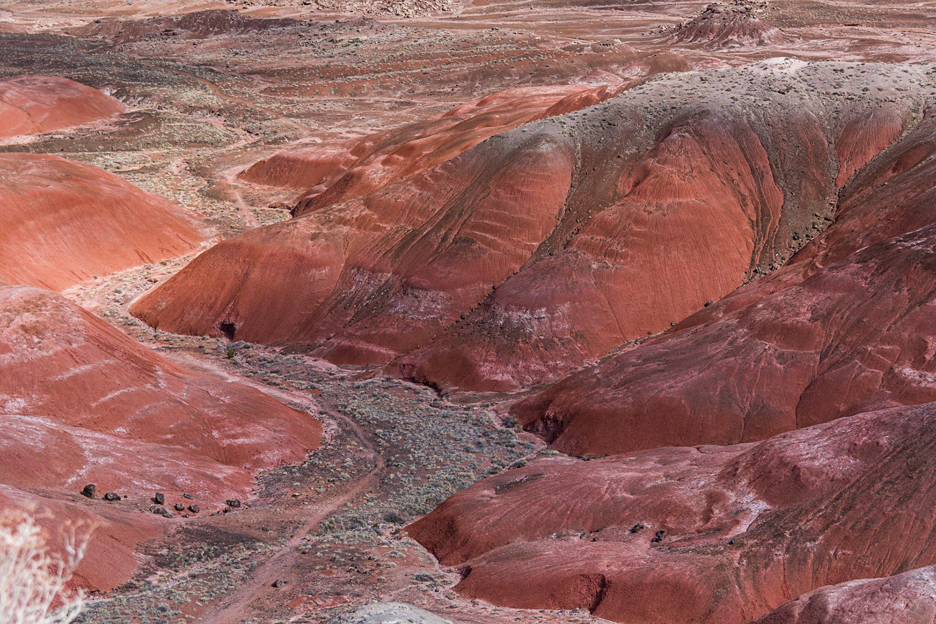
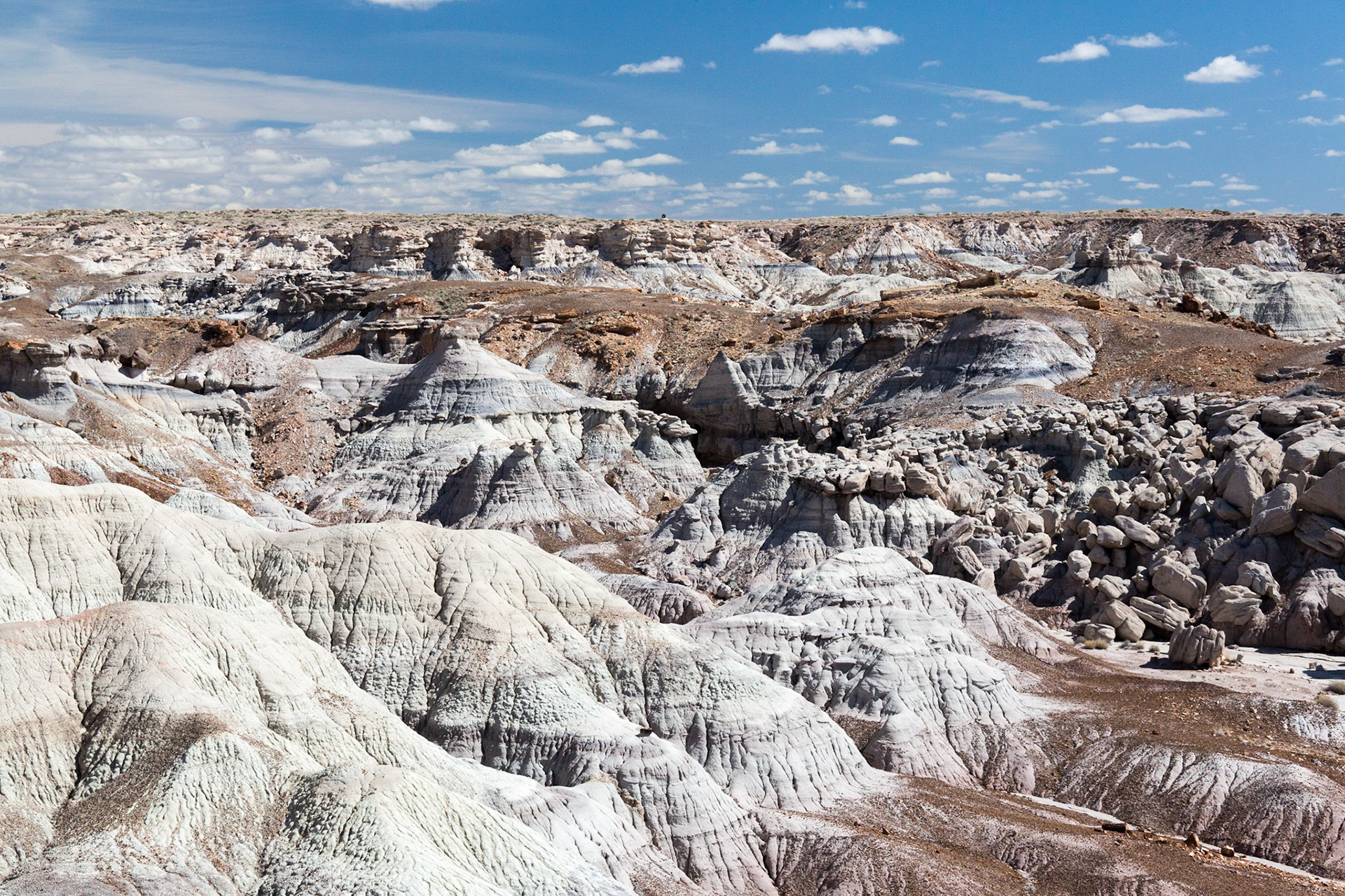
Blue Mesa. Petrified Forest National Park, Arizona, USA (3/2020)
Petrified Tree, Blue Mesa. Petrified Forest National Park, Arizona, USA (3/2020)
Blue Mesa. Petrified Forest National Park, Arizona, USA (3/2020)
Blue Mesa. Petrified Forest National Park, Arizona, USA (3/2020)
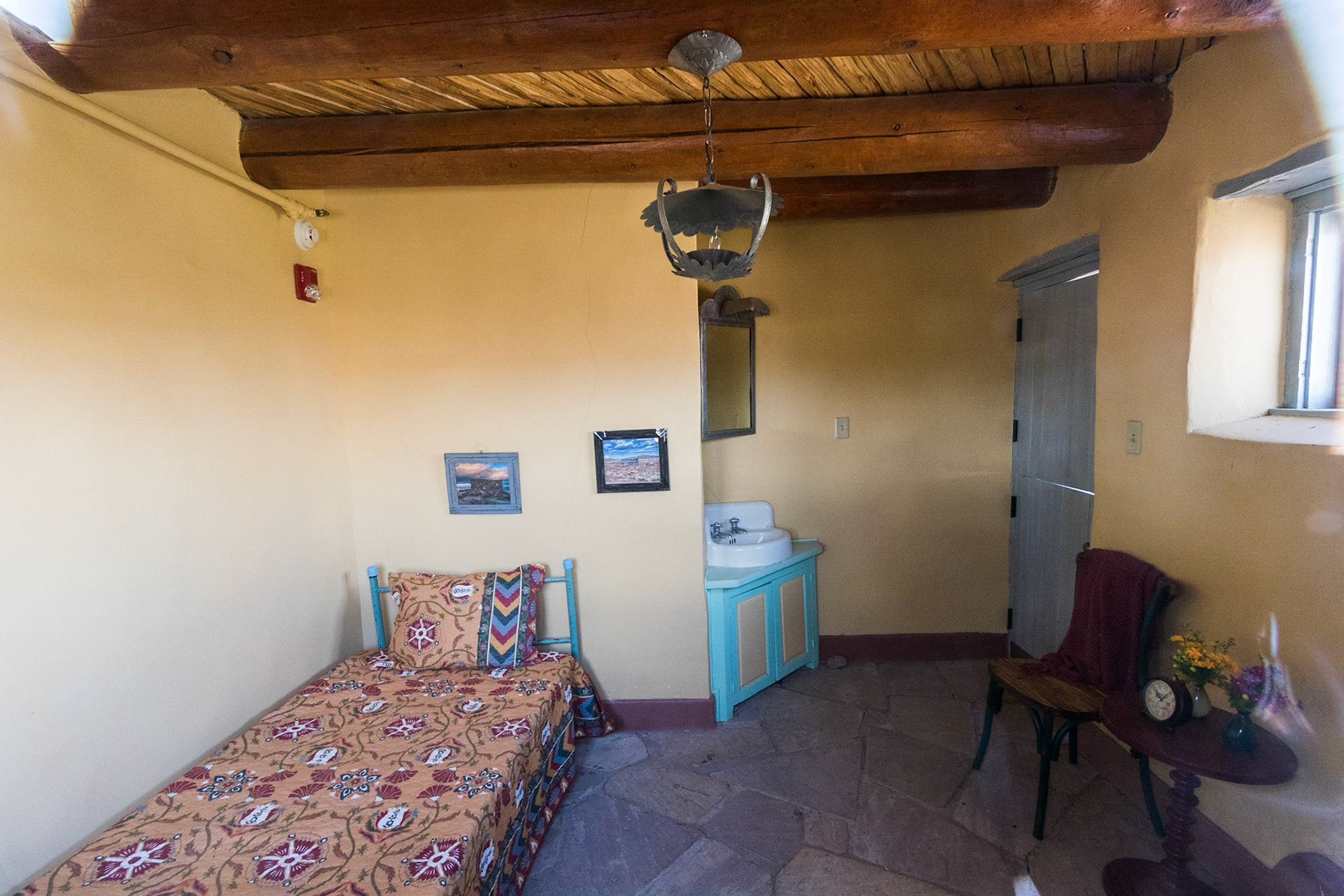
Guest / Staff room, Painted Desert Inn Harvey House, Painted Destert - Petrified Forest National Park, Arizonoa USA (3/2020)
Painted Desert Inn, Painted Desert - Petrified Forest National Park, Arizona, USA (3/2020)